 Catalogo de metadatos del IGME
infoMapAccessService
Type of resources
Available actions
Topics
Keywords
Contact for the resource
Provided by
Years
Formats
Representation types
Update frequencies
status
Service types
Scale
-
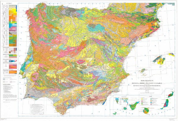
Geological map of the Iberian Peninsula, Balearic and Canary Islands at 1M scale. It includes the chronolithostratigraphic units and the representation of the tectonic structure by means of faults and thrusts.
-
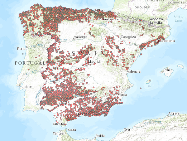
Ground Movement Database Visualisation Service (BDMOVES)
-
The map show the number of trajectories that pass through each pixel.
-
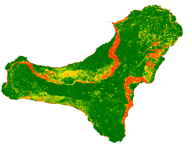
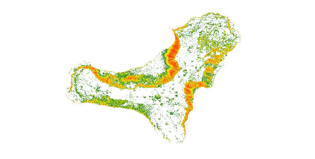
The map shows a probabilistic identification of rockfall source areas for El Hierro Island, prepared with the combination of multiple statistical models. To run the models, we have used observed source areas as dependent variable and a set of thematic information as independent variables (e.g., morphometric parameters derived from the DTM, lithological information that considers the mechanical behaviour of the rocks).
-
Servicio de visualización que muestra las Unidades Administrativas y Límites Administrativos con tres niveles de administración (comunidad autónoma, provincia y municipio). Cada capa posee el nombre, título y estilo que establece Inspire y un estilo definido por el IGN. Esta información forma parte del Equipamiento Geográfico de Referencia Nacional, según se recoge en el Anexo I, parte 1 de LISIGE: Unidades administrativas en que se dividan las áreas en las que los Estados miembros tienen y/o ejercen derechos jurisdiccionales, a efectos de administración local, regional y nacional, separadas por límites administrativos. Servicio de visualización WMS 1.3.0 conforme al perfil Inspire de ISO 19128:2005.
-
The service consists of two layers of dots symbolising the position of mineral occurrences for the entire national territory. Depending on the scale of visualisation, two layers of information have been created. Indications I: Only the location of the points is represented. Visible from scales smaller than 1:200.000. Indications II: The points are represented with a symbolisation according to different attributes. Visible from scales larger than 1:200,000. The reference systems offered by this service are:CRS:84, EPSG:4326, EPSG:4258, EPSG:4230, EPSG:23028, EPSG:23029, EPSG:23030, EPSG:23031, EPSG:25828, EPSG:25829, EPSG:25830, EPSG:25831
-

Mapa con las unidades cronolitoestratigráficas de la provincia de Alicante acompañado de fallas y estructuras de plegamiento. Forma parte de una síntesis geológica unificada de la Comunidad Valenciana.
-
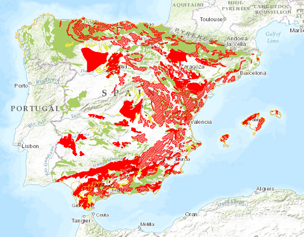
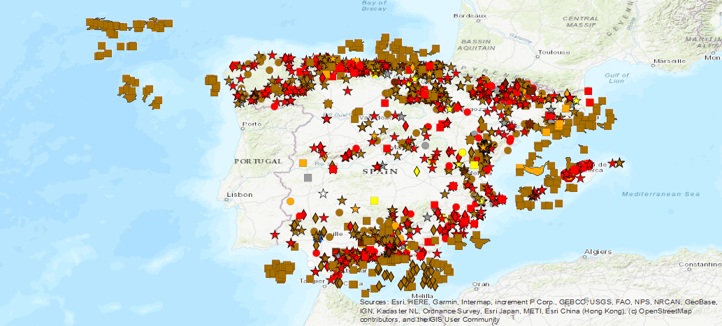
Map showing the geographical distribution of ground movements classified into four main groups: horizontal component in continental areas, vertical component in continental areas, unstable areas linked to coastal areas and movements related to mining operations. Also included are continental areas with important erosive processes.
-
The map show the number of trajectories that pass through each pixel.
-
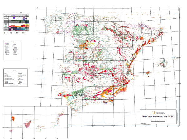
This map shows deposits dated as Plio-Pleistocene to contemporary, classified in 10 geochronological intervals and separated according to their genesis. Glacial, volcanic, karstic, aeolian, littoral, edaphic, palaeontological and prehistoric entities are included.