 Catalogo de metadatos del IGME
Geology
Type of resources
Available actions
Topics
Keywords
Contact for the resource
Provided by
Years
Formats
Representation types
Update frequencies
status
Service types
Scale
-
A database of faults showing geological evidence of activity during the Quaternary period in Iberia (last 2.6 million years according to the official limit set by IQS in 2009). The Quaternary Active Fault Database of Iberia (QAFI) is a project under constant revision and updating as a consequence of the advancing studies and knowledge on the structures capable of generating earthquakes in Iberia. QAFI could never be considered complete or definitive, due to the scientific nature of the data that contains in it as well as for the modus operandi followed in its construction: the altruist cooperation of a large number of Earth science researchers. The database (mdb. and shp. format) is hosted and maintained by the Geological Survey of Spain (IGME) and is accessible to the research and technical community and to society in general.
-
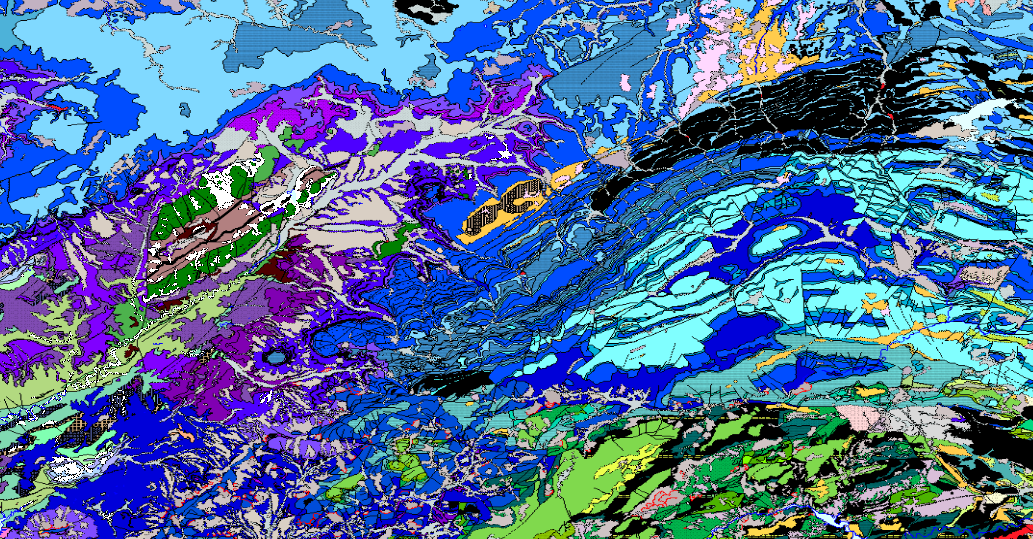
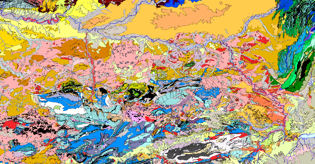
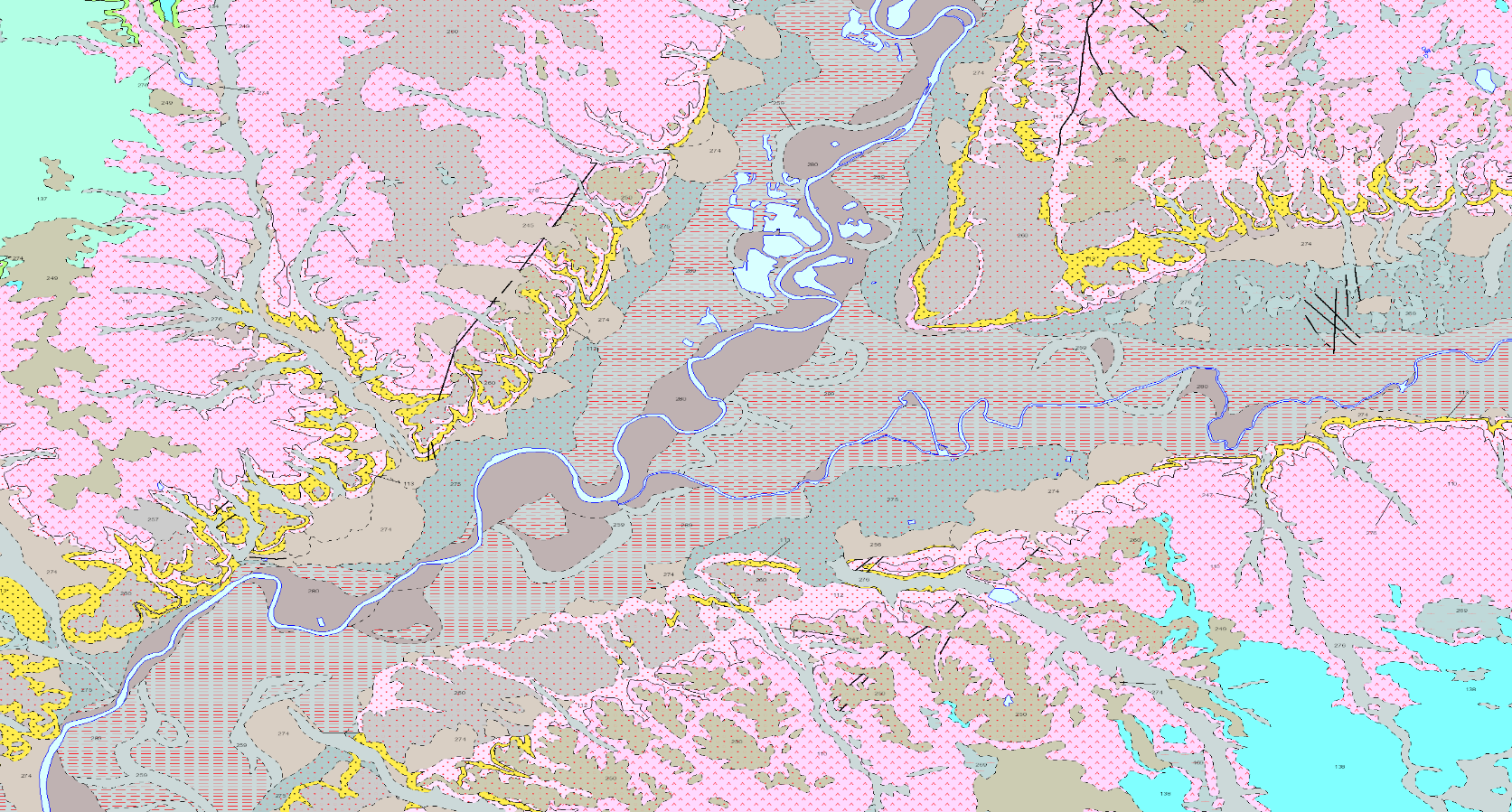
This map represents the result of the cartographic homogenisation of the MAGNA geological map series (National Geological Cartography at a scale of 1:50.000). Series that integrates 1143 maps. As a consequence of the long process involved in the historical execution of this series, there are differences between its initial and final phases, in terms of criteria for assigning geological units, level of detail, continuity of geological units and structures at the edges of sheets, coding and symbologies. With the aim of correcting these problems, the GEODE PLAN was initiated in 2004, which constitutes the institutional support for the generation of a continuous digital geological map at a scale of 1:50,000. The PLAN integrates 19 Regional Projects linked to their corresponding geological zones. Its fundamental objectives are threefold: - To provide cartographic continuity to the geological sheets of the MAGNA series within each region. - To generate a unified legend of geological units for each region. - To adapt the geological coverage to a uniform topographic base, generated specifically for the GEODE PLAN from the national topographic map 1:25000 of the IGN.
-
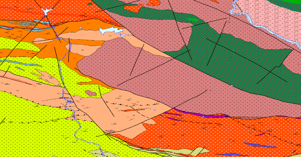
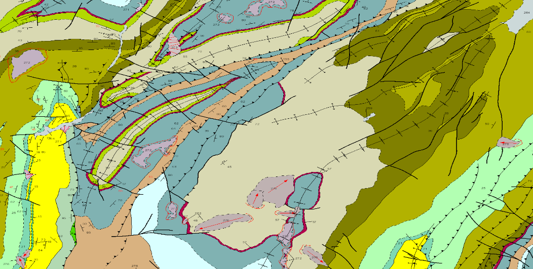
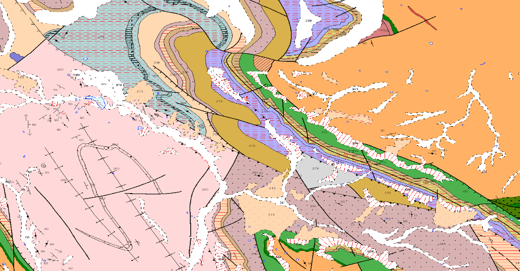
GEOLOGICAL CARTOGRAPHY is the representation of surface materials on the basis of their lithological, stratigraphic, structural, age, etc. characteristics. It is composed of the following levels of information: Z2800MRGEO: Cartographic units, differentiated geological enclosures; Z2800MPGEO: Geological enclosure labels; Z2800MLGEO: Auxiliary anchor lines of the geological polygon labels; Z2800MLCON: Contact and fault lines. Linear entities of diverse origin; Z2800MPBUZ: Points and labels of point entities and structural measures.
-
Mining heritage map of Galicia, at a scale of 1:400.000, in which, on a simplified geological basis on a simplified geological base, a selection of points considered to be of mining heritage interest in Galicia has been represented.
-
GEOLOGICAL CARTOGRAPHY is the representation of surface materials on the basis of their lithological, stratigraphic, structural, chronological, etc. characteristics. It is composed of the following levels of information: Z1800MRGEO: Cartographic units, differentiated geological enclosures; Z1800MPGEO: Geological enclosure labels; Z18006MLGEO: Auxiliary anchor lines of geological polygon labels; Z1800MLCON: Contact and fault lines. Linear entities of diverse origin; Z1800MPBUZ: Points and labels of point entities and structural measures.
-
GEOLOGICAL CARTOGRAPHY is the representation of surface materials on the basis of their lithological, stratigraphic, structural, age, etc. characteristics. It is composed of the following levels of information: Z2600MRGEO: Cartographic units, differentiated geological enclosures; Z2600MPGEO: Geological enclosure labels; Z2600MLGEO: Auxiliary anchor lines of geological polygon labels; Z2600MLCON: Contact and fault lines. Linear entities of diverse origin; Z2600MPBUZ: Points and labels of point entities and structural measures.
-
GEOLOGICAL CARTOGRAPHY is the representation of surface materials on the basis of their lithological, stratigraphic, structural, age, etc. characteristics. It is composed of the following levels of information: Z3100MRGEO: Cartographic units, differentiated geological enclosures; Z3100MPGEO: Geological enclosure labels; Z3100MLGEO: Auxiliary anchor lines of geological polygon labels; Z3100MLCON: Contact and fault lines. Linear entities of diverse origin; Z3100MPBUZ: Points and labels of point entities and structural measure
-
GEOLOGICAL CARTOGRAPHY is the representation of surface materials on the basis of their lithological, stratigraphic, structural, age, etc. characteristics. It is composed of the following levels of information: Z1100MRGEO: Cartographic units, differentiated geological enclosures; Z1100MPGEO: Geological enclosure labels; Z11006MLGEO: Auxiliary anchor lines of geological polygon labels; Z1100MLCON: Contact and fault lines. Linear entities of diverse origin; Z1100MPBUZ: Points and labels of point entities and structural measures; Z1100MLCON: Contact lines and faults.
-
GEOLOGICAL CARTOGRAPHY is the representation of the surface materials on the basis of their lithological, stratigraphic, structural, age, etc. characteristics. It is composed of the following levels of information: Z2400MRGEO: Cartographic units, differentiated geological enclosures; Z2400MPGEO: Geological enclosure labels; Z2400MLGEO: Auxiliary anchor lines of the geological polygon labels; Z2400MLCON: Contact and fault lines. Linear entities of diverse origin; Z2400MPBUZ: Points and labels of point entities and structural measures.
-
GEOLOGICAL CARTOGRAPHY is the representation of surface materials on the basis of their lithological, stratigraphic and structural characteristics. It is composed of the following levels of information: Z1400MRGEO: Cartographic units, differentiated geological enclosures; Z1400MPGEO: Geological enclosure labels; Z1400MLGEO: Auxiliary anchor lines of geological polygon labels; Z1400MLCON: Contact and fault lines. Linear entities of diverse origin; Z1400MPBUZ: Points and labels of point entities and structural measures; Z1400CODEEDAD. The geographical scope of the project covers part of the following Autonomous Communities: Extremadura, Castilla-La Mancha, Andalusia.