Geographic model/information management service
Type of resources
Available actions
Keywords
Contact for the resource
Provided by
Years
Formats
status
Service types
-
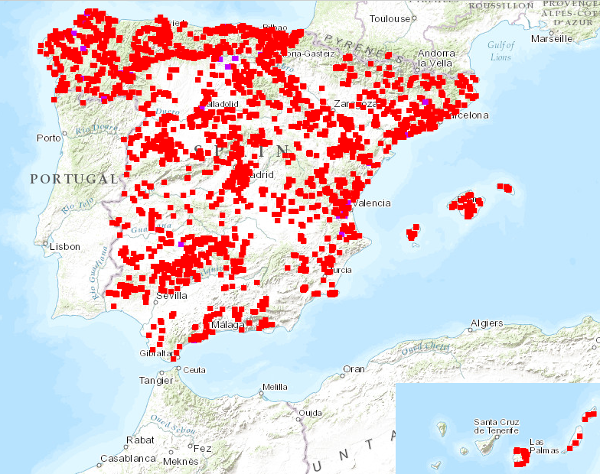
Visualisation service of the National Inventory of Mixed Type Trenches and Structures, with information on physical and geographical characteristics, type of mining, geological characteristics, impact on the environment, possibility of exploitation, etc. Information compiled up to 1989. The reference systems offered by this service are: CRS:84, EPSG:4326, EPSG:4258, EPSG:4230, EPSG:23028, EPSG:23029, EPSG:23030, EPSG:23031, EPSG:25828, EPSG:25829, EPSG:25830, EPSG:25831.
-
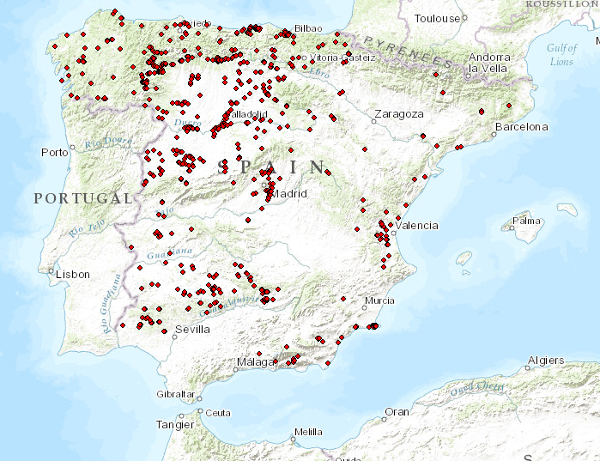
Updating of the National Inventory of Sludge Deposits in the treatment process of extractive industries that was carried out in 2002. The reference systems offered by this service are: CRS: 84, EPSG: 4326, EPSG: 4258, EPSG: 4230, EPSG: 23028, EPSG: 23029, EPSG: 23030, EPSG: 23031, EPSG: 25828, EPSG: 25829, EPSG: 25830, EPSG: 25831..
-
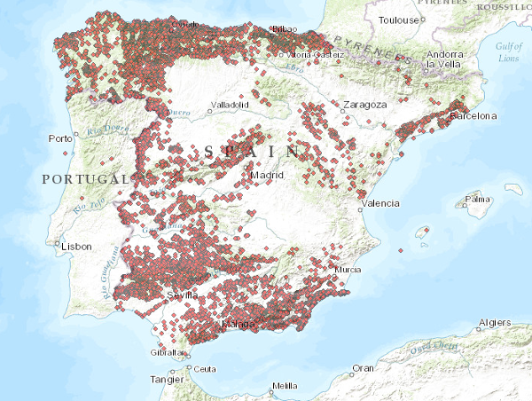
The service consists of two layers of dots symbolising the position of mineral occurrences for the entire national territory. Depending on the scale of visualisation, two layers of information have been created. Indications I: Only the location of the points is represented. Visible from scales smaller than 1:200.000. Indications II: The points are represented with a symbolisation according to different attributes. Visible from scales larger than 1:200,000. The reference systems offered by this service are:CRS:84, EPSG:4326, EPSG:4258, EPSG:4230, EPSG:23028, EPSG:23029, EPSG:23030, EPSG:23031, EPSG:25828, EPSG:25829, EPSG:25830, EPSG:25831
-
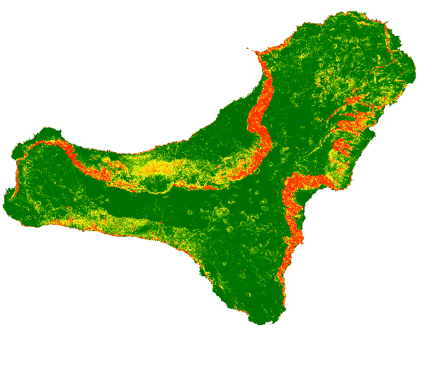
The map shows a probabilistic identification of rockfall source areas for El Hierro Island, prepared with the combination of multiple statistical models
-
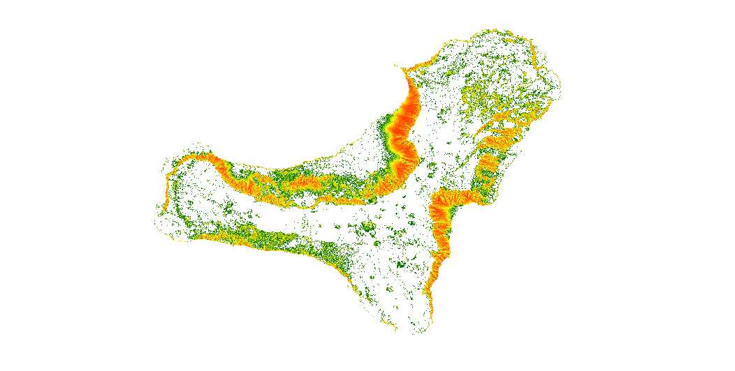
The map show the number of trajectories that pass through each pixel.
-
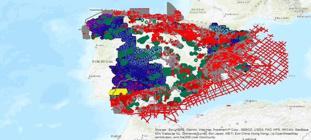
Geophysical database visualization service available in the IGME corresponding to the following methodologies: Electrical (SEV, SEDT and Electrical Profiles), Witnessing, Gravimetry, Petrophysics, Aeroportado (flight lines and meshes), Electomagnetic (MT) and Seismic (seismic lines and seismic sections ).
-
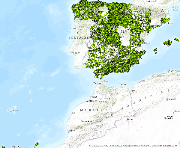
Points that symbolize the position of the indications or exploitations of Rocks and Industrial Minerals for all the national territory. Depending on the scale of visualization, two layers of points have been created. Exploitations I: represents only the location of the points. Visible from scales smaller than 1:200.000.Exploitations II: represents the location of the points with a symbolization according to different attributes. Visible from scales greater than 1:200,000. The reference systems offered by this service are: CRS:84, EPSG:4326, EPSG:4258, EPSG:4230, EPSG:23028, EPSG:23029, EPSG:23030, EPSG:23031, EPSG:25828, EPSG:25829, EPSG:25830, EPSG:25831. Puntos que simbolizan la posición de los indicios o explotaciones de Rocas y Minerales Industriales para todo el territorio nacional. En función de la escala de visualización se ha creado dos capas de puntos. Explotaciones I: representa tan sólo la localización de los puntos. Visible a partir de escalas menores de 1:200.000.Explotaciones II: representa la localización de los puntos con una simbolización en función de distintos atributos. Visible a partir de escalas mayores de 1:200.000.. Los sistemas de referencia que ofrece este servicio son:CRS:84, EPSG:4326, EPSG:4258, EPSG:4230, EPSG:23028, EPSG:23029, EPSG:23030, EPSG:23031, EPSG:25828, EPSG:25829, EPSG:25830, EPSG:25831..
 Catalogo de metadatos del IGME