 Catalogo de metadatos del IGME
Fold
Type of resources
Available actions
Topics
Provided by
Representation types
Update frequencies
status
Scale
-
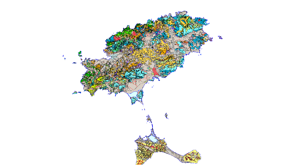
GEOLOGICAL CARTOGRAPHY is the representation of surface materials on the basis of their lithological, stratigraphic, structural, age, etc. characteristics. It is composed of the following levels of information: Z1000MRGEO: Cartographic units, differentiated geological enclosures; Z1000MPGEO: Geological enclosure labels; Z1000MLGEO: Auxiliary anchor lines of the geological polygon labels; Z1000MLCON: Contact and fault lines. Linear entities of diverse origin; Z1000MPBUZ: Points and labels of point entities and structural measures; Z1000CODEEDAD.
-
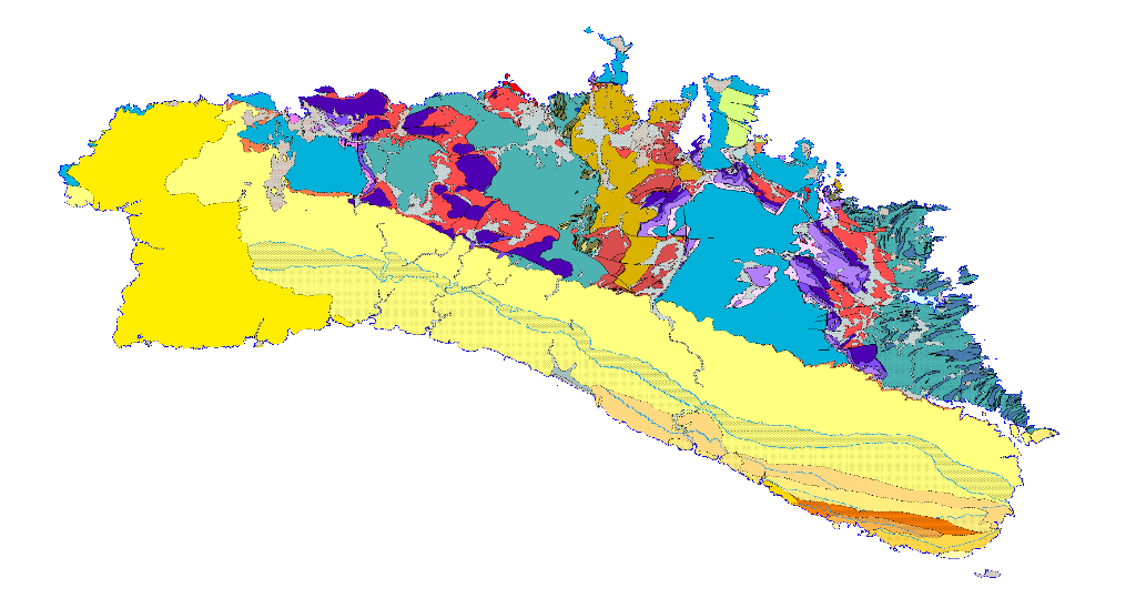
GEOLOGICAL CARTOGRAPHY is the representation of surface materials on the basis of their lithological, stratigraphic, structural, age, etc. characteristics. It is composed of the following levels of information: Z2211MRGEO: Cartographic units, differentiated geological enclosures; Z2212MPGEO: Geological enclosure labels; Z12212MLGEO: Auxiliary anchor lines of geological polygon labels; Z2212MLCON: Contact and fault lines. Linear entities of diverse origin; Z2212MPBUZ: Points and labels of point entities and structural measures.
-
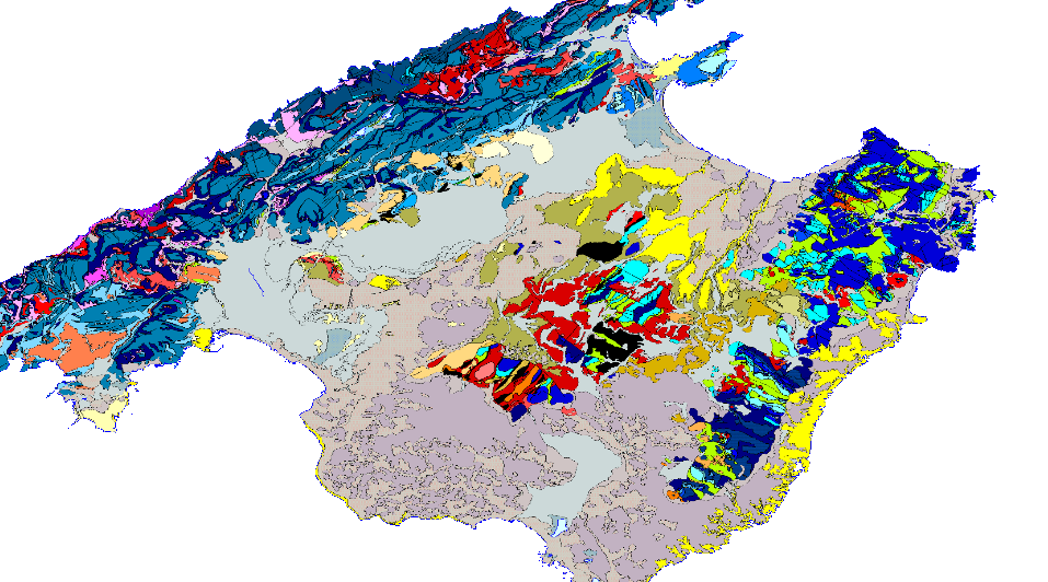
GEOLOGICAL CARTOGRAPHY is the representation of surface materials on the basis of their lithological, stratigraphic, structural, age, etc. characteristics. It is composed of the following levels of information: Z2210MRGEO: Cartographic units, differentiated geological enclosures; Z2210MPGEO: Geological enclosure labels; Z12210MLGEO: Auxiliary anchor lines of geological polygon labels; Z2210MLCON: Contact and fault lines. Linear entities of diverse origin; Z2210MPBUZ: Points and labels of point entities and structural measures.
-
GEOLOGICAL CARTOGRAPHY is the representation of surface materials on the basis of their lithological, stratigraphic and structural characteristics. It is composed of the following levels of information: Z1600MRGEO: Cartographic units, differentiated geological enclosures; Z1600MPGEO: Geological enclosure labels; Z1600MLGEO: Auxiliary anchor lines of geological polygon labels; Z1600MLCON: Contact and fault lines. Linear entities of diverse origin; Z1600MPBUZ: Points and labels of point entities and structural measurements; Z1600CODEEDAD. The geographical scope of the project covers part of the following Autonomous Communities: Asturias, Cantabria, Basque Country, Navarre, Castile and Leon, Aragon, Catalonia and La Rioja.
-
GEOLOGICAL CARTOGRAPHY is the representation of surface materials on the basis of their lithological, stratigraphic, structural, age, etc. characteristics. It is composed of the following levels of information: Z2211MRGEO: Cartographic units, differentiated geological enclosures; Z2211MPGEO: Geological enclosure labels; Z12211MLGEO: Auxiliary anchor lines of geological polygon labels; Z2211MLCON: Contact and fault lines. Linear entities of diverse origin; Z2211MPBUZ: Points and labels of point entities and structural measures.
-
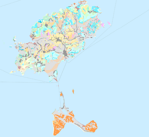
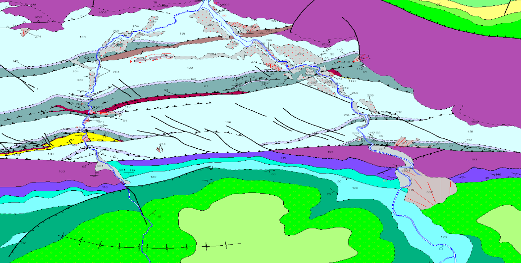
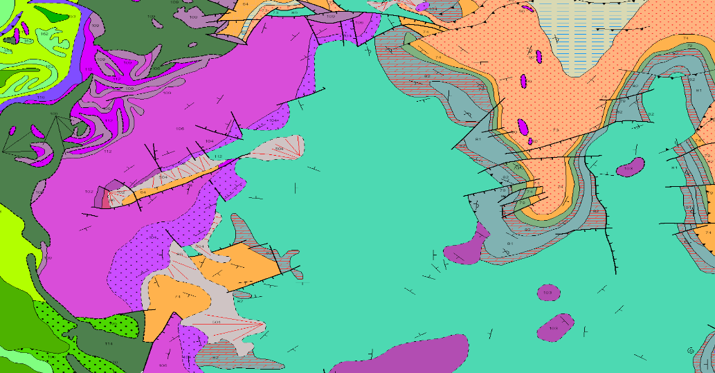
Map showing the chronolithostratigraphic units of the area covered by the sheet separated by different types of contacts: normal or concordant, discordant and mechanical or intrusive. The tectonic structure is represented by the cartographic traces of the folds, the orientation and dip of the planar and linear elements contained in the rocks, as well as by the structural relationship -by means of faults and thrusts- between the rock assemblages differentiated cartographically. The map is accompanied by the lithostratigraphic legend and conventional signs.