 Catalogo de metadatos del IGME
COUNTRIES
Type of resources
Available actions
Topics
Keywords
Contact for the resource
Provided by
Years
Formats
Representation types
Update frequencies
status
Service types
Scale
-
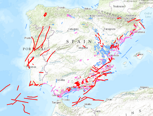
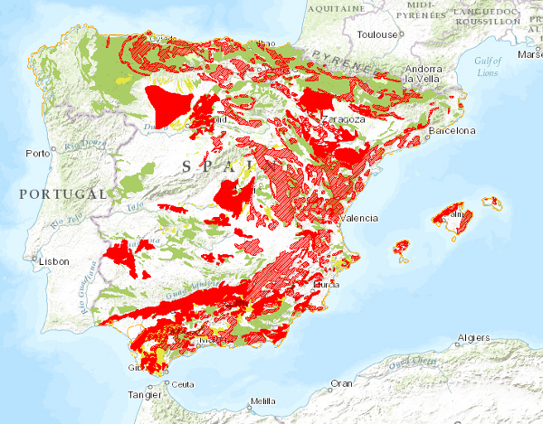
A database of faults showing geological evidence of activity during the Quaternary period in Iberia (last 2.6 million years according to the official limit set by IQS in 2009). The Quaternary Active Fault Database of Iberia (QAFI) is a project under constant revision and updating as a consequence of the advancing studies and knowledge on the structures capable of generating earthquakes in Iberia. QAFI could never be considered complete or definitive, due to the scientific nature of the data that contains in it as well as for the modus operandi followed in its construction: the altruist cooperation of a large number of Earth science researchers. The database (mdb. and shp. format) is hosted and maintained by the Geological Survey of Spain (IGME) and is accessible to the research and technical community and to society in general.
-
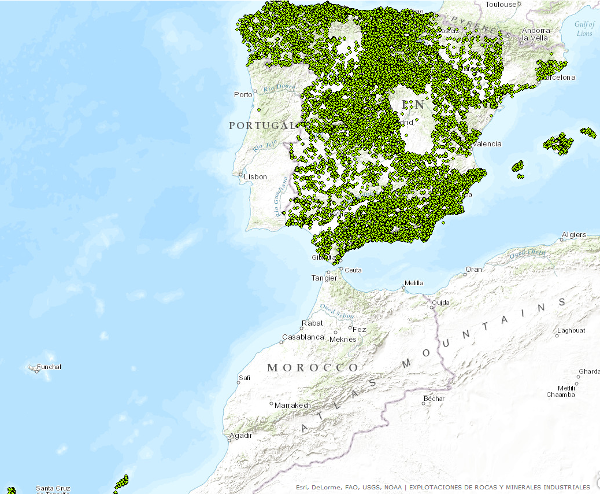
Dataset contains information related to the mining operations (both abandoned or operating continuously or intermittently) and minerals occurrences of industrial minerals and rocks. These data have been generated by the IGME along numerous projects since the early 70s to the present. It has national coverage.
-
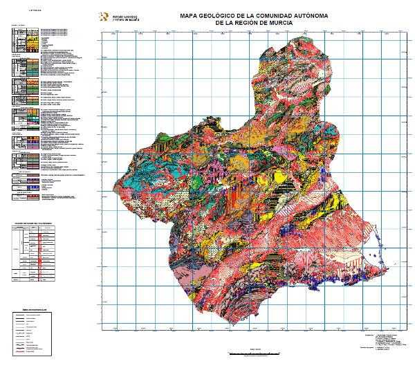
Map showing the chronolithostratigraphic units of the Region of Murcia grouped by the different structural domains present in the region, accompanied by the tectonic structure expressed by faults and traces of folding structures. On the Neogene and Quaternary units, the different facies present in each of them have been differentiated, reflecting the sedimentation domain and system, the geomorphological unit and the lithology.
-

Mapa con las unidades cronolitoestratigráficas de la provincia de Alicante acompañado de fallas y estructuras de plegamiento. Forma parte de una síntesis geológica unificada de la Comunidad Valenciana.
-
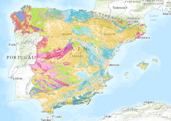
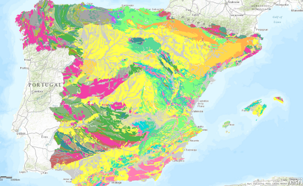
The lithological map at a scale of 1:1,000,000 has been obtained by assigning the most representative lithology or lithological association to each cartographic unit on the map. It has been based on the original classification of the edited map, which has been subsequently revised, giving rise to the current classification.
-
Map delimiting the areas with different types of land movements, representing the most intense and frequent movements. It therefore shows the distribution and extent of the most problematic areas from a practical point of view. Land movements are classified into four main groups: horizontal component movements (landslides and landslides), vertical component movements (subsidence and subsidence, and expansive clays), unstable processes in coastal areas and movements related to mining operations. Areas with significant erosion processes are also included. This map, published in 1987, was drawn up entirely by staff of the Geological Survey of Spain in response to the need for information on geological hazards and risks on a national scale.
-
Map showing the chronolithostratigraphic units of the area covered by the sheet separated by different types of contacts: normal or concordant, discordant, intrusive and other. The tectonic structure is represented by the cartographic traces of folds, the orientation and dip of planar and linear elements contained in the rocks, as well as by the structural relationship - through faults and thrusts - between the cartographically differentiated rock assemblages. Unique features of the igneous rocks as well as the degree of migmatisation of the metamorphic rocks are also depicted. The map is accompanied by the lithostratigraphic legend and conventional signs.
-
Map with the chronolithostratigraphic and igneous units of the province of Badajoz grouped together as a support for the mapping of mineral resources in the province. The contacts between the different cartographic units have been classified as "stratigraphic contact" and "intrusive contact". The tectonic structure is expressed by faults.
-
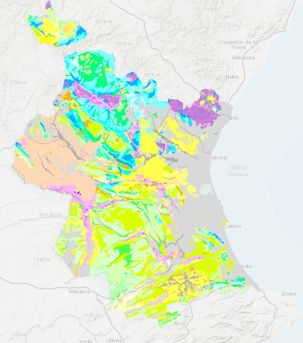
Map showing the chronolithostratigraphic units of the province of Valencia with faults and folding structures. It forms part of a unified geological synthesis of the Valencian Community.
-
The geological age map of the units at a scale of 1:1,000,000 has been generated from the information in the chronolithostratigraphic column of the map. In all units the System has been specified, the Series has only been covered in about half of the units and the Floor is occasional. In cases where it has not been possible to establish a chronostratigraphic section, the value "undetermined" has been assigned.