 Catalogo de metadatos del IGME
image/tiff
Type of resources
Available actions
Keywords
Contact for the resource
Provided by
Years
Formats
status
Service types
-
Geological map of the South Portuguese Zone on a scale of 1/200,000, in which the geological legend on both sides of the border has been harmonised with unified criteria between Spain and Portugal. This cartography is a product of the GEO_FPI project: Cross-border Observatory for the geo-economic exploitation of the Iberian Pyrite Belt, co-financed by ERDF funds through the INTERREG POCTEP 2014-2020 territorial cooperation programme. The main beneficiary of the project is the Geological Survey of Spain (IGME). The partnership for this project includes the Directorate-General for Industry, Energy and Mines of the Ministry of Finance, Industry and Energy of the Andalusian Regional Government (DGIEM), the National Laboratory of Energy and Geology, I.P. (LNEG) and the Municipal Chamber of Aljustrel (CMA).
-
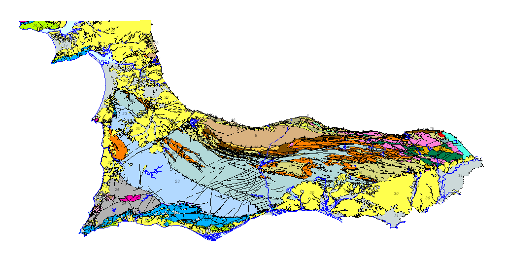
Geological map of the South Portuguese Zone, at a scale of 1/400,000, in which the geological legend on both sides of the border has been harmonized, with unified criteria between Spain and Portugal. This cartography is a product resulting from the GEO_FPI project: GEO_FPI: cross-border observatory for the geo-economic evaluation of the Iberian Pyrite Belt, financed by the European Regional Development Fund (ERDF) within the program INTERREG V-A Spain– Portugal (POCTEP) 2014-2020. The main beneficiary of the project is the Geological Survey of Spain (IGME) . Additionally, the General Directorate of Industry, Energy and Mines of the Ministry of Employment, Enterprise and Commerce of the Andalusian Government (JA) and the Portuguese National Laboratory for Energy and Geology (LNEG) and the Municipal Chamber of Aljustrel (CMA) are partners of the project.
-
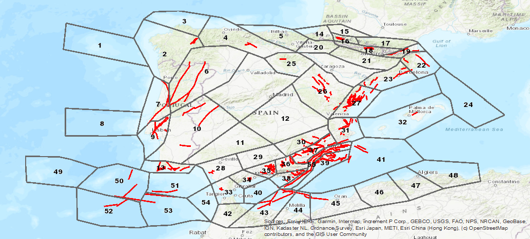
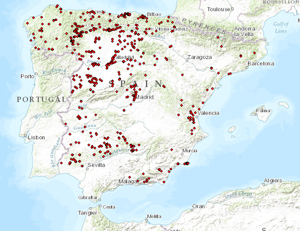
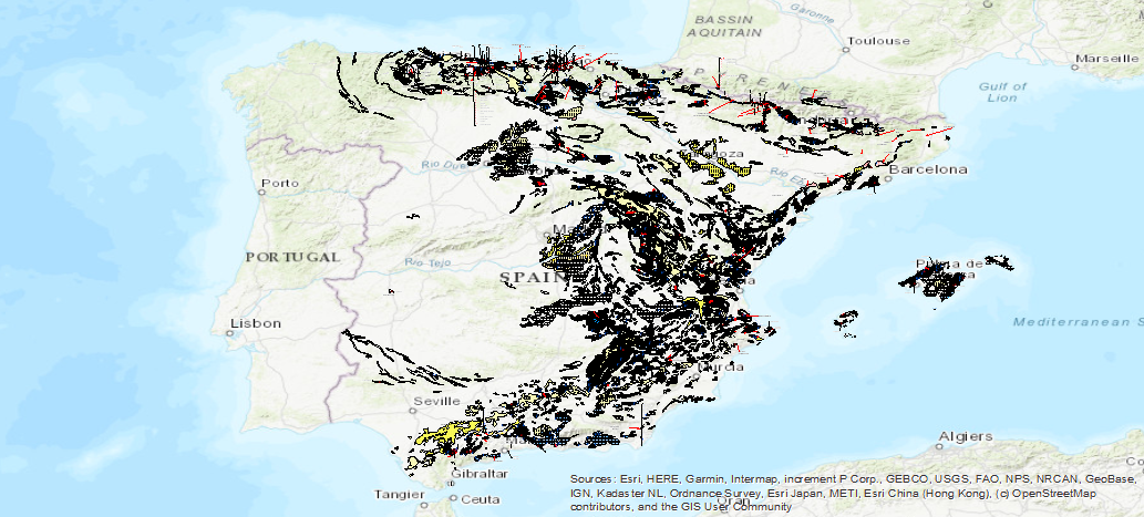
Database visualization service of seismogenic zones of the Iberian Peninsula and territories of influence for the calculation of seismic hazard in Spain (ZESIS)
-
Rocks and industrial minerals map in the South Portuguese Zone, on a scale of 1/400,000, which, on a harmonised geological basis, with unified criteria between Spain and Portugal, has represented the main exploitations and indications of rocks and industrial minerals in the area, indicating their state (active, abandoned or intermittent), size, use and substance. This cartography is a product of the project GEO_FPI: Cross-border Observatory for the geo-economic exploitation of the Iberian Pyrite Belt, co-financed by ERDF funds through the INTERREG POCTEP 2014-2020 territorial cooperation programme. The main beneficiary of the project is the Geological Survey of Spain (IGME). The partnership for this project includes the Directorate-General for Industry, Energy and Mines of the Ministry of Finance, Industry and Energy of the Andalusian Regional Government (DGIEM), the National Laboratory of Energy and Geology, I.P. (LNEG) and the Municipal Chamber of Aljustrel (CMA).
-
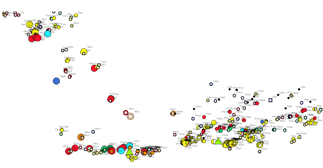
Metallogenic map of the South Portuguese Zone at a scale of 1 / 400,000, in which on the harmonized geological basis, with unified criteria between Spain and Portugal, the main metallic mineral occurrences located in the area have been represented, indicating their magnitude, substance and morphology. This cartography is a product resulting from the GEO_FPI project: GEO_FPI: cross-border observatory for the geo-economic evaluation of the Iberian Pyrite Belt, financed by the European Regional Development Fund (ERDF) within the program INTERREG V-A Spain– Portugal (POCTEP) 2014-2020. The main beneficiary of the project is the Geological Survey of Spain (IGME). Additionally, the General Directorate of Industry, Energy and Mines of the Ministry of Employment, Enterprise and Commerce of the Andalusian Government (JA) and the Portuguese National Laboratory for Energy and Geology (LNEG) and the Municipal Chamber of Aljustrel (CMA) are partners of the project.
-
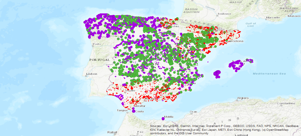
Ground Movement Database Visualisation Service (BDMOVES)
-
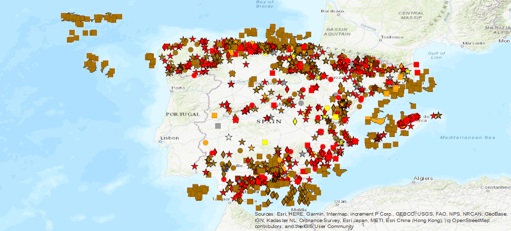
Service of visualization of the database of the Spanish Inventory of Places of Geological Interest (IELIG) which, in accordance with Law 42/2007, is prepared and updated by the Ministry of Agriculture, Food and the Environment, with the collaboration of the Autonomous Communities and scientific institutions. Royal Decree 1274/2011 entrusts the IGME with the completion of this inventory, without prejudice to the actions that the Autonomous Communities, in the use of their powers, carry out to complete it in their respective territories. For this reason, in the "origin" field of each LIG file it is indicated whether the site has been inventoried in IGME inventory or cartographic projects, in the international project Global Geosites or in autonomic inventory projects.
-
Updating of the National Inventory of Sludge Deposits in the treatment process of extractive industries that was carried out in 2002. The reference systems offered by this service are: CRS: 84, EPSG: 4326, EPSG: 4258, EPSG: 4230, EPSG: 23028, EPSG: 23029, EPSG: 23030, EPSG: 23031, EPSG: 25828, EPSG: 25829, EPSG: 25830, EPSG: 25831..
-
Service of visualization of the Map of the Karst in Spain on a scale 1:1.000.000, which gathers the different 'karstifiable' lithologies indicating their type (carbonates, gypsums and detritus), and the intensity of karstification in each one of the zones. Also included are caves, poles, outcrops and other hydrogeological and geomorphological entities linked to karstification processes.
-
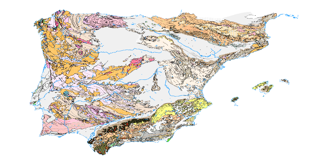
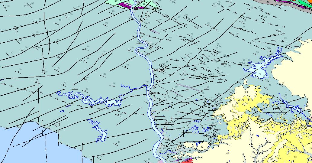
Visualisation service of the Tectonic Map in Spain at a scale of 1:1,000,000, of the Iberian Peninsula and Balearic Islands that identifies the major structural elements of the Earth's crust, and records the Earth's dynamism in the past.