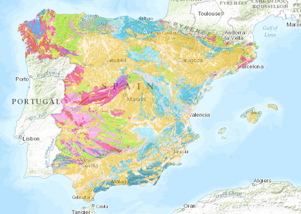
Geological_Cartography/IGME_Lithologies_1M
El mapa litológico a escala 1:1.000.000 se ha obtenido asignando a cada unidad cartográfica del mapa la litología o asociación litológica más representativa. Se ha partido de la clasificación original del mapa editado, que ha sido revisada posteriormente dando lugar a la clasificación actual.
The lithological map at a scale of 1:1,000,000 has been obtained by assigning the most representative lithology or lithological association to each cartographic unit on the map. It has been based on the original classification of the edited map, which has been subsequently revised, giving rise to the current classification.
Simple
Identification info
- Date (Publication)
- 2009-03-01
- Status
- Completed
-
CEOLocation
CEOLocation
-
-
COUNTRIES
COUNTRIES
-
SPAIN
SPAIN
-
- Keywords
-
-
IGME
IGME
-
IDEE
IDEE
-
España
Spain
-
Litologías
Lithologies
-
- Keywords
-
-
EGDI
EGDI
-
-
INSPIRE_SpatialDataServicesClassification
INSPIRE_SpatialDataServicesClassification
-
-
Servicio de acceso a mapas
Map access service
-
infoMapAccessService
infoMapAccessService
-
Servicio de gestión de modelos/información geográficos
Servicio de gestión de modelos/información geográficos
-
infoManagementService
infoManagementService
-
-
Especificaciones de Servicios Web
Web Services Specifications
-
-
OGC (Open Geospatial Consortium)
OGC (Open Geospatial Consortium)
-
WMS (Web Map Service)
WMS (Web Map Service)
-
WMS 1.3.0
WMS 1.3.0
-
OGC
OGC
-
WMS
WMS
-
- Access constraints
- Other restrictions
- Other constraints
- No limitations on public access.
- Use constraints
- Other restrictions
- Other constraints
-
LICENCIA DE USO: Condiciones de uso público y difusión de la información para la reutilización de los datos IGME http://www.igme.es/Ayuda/CondiUso.htm
LICENCE OF USE: Conditions of public use and dissemination of information for the re-use of IGME data. http://www.igme.es/Ayuda/CondiUso.htm
- Service Type
- view
))
- Coupling Type
- Ajustado
Contains Operations
- Operation Name
-
GetCapabilities
- Distributed Computing Platforms
- Web services
- Connect Point
- URL de acceso ( OGC Web Map Service )
Contains Operations
- Operation Name
-
GetMap
- Distributed Computing Platforms
- Web services
- Connect Point
- URL de acceso ( OGC Web Map Service )
Contains Operations
- Operation Name
-
GetfeatureInfo
- Distributed Computing Platforms
- Web services
- Connect Point
- URL de acceso ( OGC Web Map Service )
- Distribution format
-
- OnLine resource
- Link to the GetCapabilities of the web service hosting the product ( OGC:WMS-1.3.0-http-get-capabilities )
- Hierarchy level
- Service
- Other
-
Servicio de visualización
Conformance result
- Date (Publication)
- 2009-10-19
- Explanation
-
Consultar el reglamento mencionado
Consult the above-mentioned regulation
- Pass
- No
Conformance result
- Date (Publication)
- 2010-12-08
- Explanation
-
Consultar el reglamento
Consult the above-mentioned regulation
- Pass
- No
Conformance result
- Date (Publication)
- 2008-12-04
Identifier
- Explanation
-
Consultar el reglamento mencionado
Consult the above-mentioned regulation
- Pass
- Yes
- File identifier
- ESPIGMESERVICIOLITOLOGICO100020110216260471 XML
- Metadata language
- Spanish; Castilian
- Character set
- UTF8
- Hierarchy level
- Service
- Hierarchy level name
-
Servicio
- Date stamp
- 2022-10-10T09:54:50
- Metadata standard name
-
Reglamento (CE) Nº 1205/2008 de Inspire, "Perfil IGME"
- Metadata standard version
-
2.0
http://www.igme.es
Overviews

Spatial extent
))
Provided by

 Catalogo de metadatos del IGME