IGME_Clays_1M
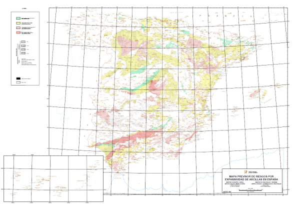
Mapa con la distribución geográfica de las zonas en las que se presupone una expansividad similar para las arcillas, la cual se ha clasificado en cuatro grupos: nula a baja, baja a moderada, moderada a alta y alta a muy alta. A las distitntas unidades cartografiadas se les ha asignado la edad (4 posibles) y la litología (7 tipos diferentes). En el mapa se representan además las formaciones superficiales sin distinción.
Map with the geographical distribution of the areas where similar expansivity is assumed for the clays, which have been classified into four groups: none to low, low to moderate, moderate to high and high to very high. The different mapped units have been assigned age (4 possible) and lithology (7 different types). The map also shows the surface formations without distinction.
Simple
Identification info
- Date (Publication)
- 2010-08-16
- Status
- Completed
-
INSPIRE_SpatialDataServicesClassification
INSPIRE_SpatialDataServicesClassification
-
-
Servicio de acceso a mapas
Map access service
-
infoMapAccessService
infoMapAccessService
-
Servicio de gestión de modelos/información geográficos
Geographic modelling/information management service
-
infoManagementService
infoManagementService
-
- Keywords
-
-
IGME
IGME
-
IDEE
IDEE
-
Arcillas
Clays
-
-
GEMET - INSPIRE themes, version 1.0
GEMET - INSPIRE themes, version 1.0
-
-
Geología
Geology
-
Zonas de riesgos naturales
Natural hazard zones
-
Natural risk zones
Natural risk zones
-
-
Especificaciones de Servicios Web
Web Services Specifications
-
-
OGC (Open Geospatial Consortium)
OGC (Open Geospatial Consortium)
-
WMS (Web Map Service)
WMS (Web Map Service)
-
WMS 1.3.0
WMS 1.3.0
-
OGC
OGC
-
WMS
WMS
-
- Keywords
-
-
EGDI
EGDI
-
- Access constraints
- Other restrictions
- Use constraints
- Other restrictions
- Other constraints
-
LICENCIA DE USO: Condiciones de uso público y difusión de la información para la reutilización de los datos IGME http://www.igme.es/Ayuda/CondiUso.htm
LICENCE OF USE: Conditions of public use and dissemination of information for the re-use of IGME data. http://www.igme.es/Ayuda/CondiUso.htm
- Service Type
- view
))
- Coupling Type
- Ajustado
Contains Operations
- Operation Name
-
GetCapabilities
- Distributed Computing Platforms
- Web services
Contains Operations
- Operation Name
-
GetMap
- Distributed Computing Platforms
- Web services
- Connect Point
- URL de acceso ( OGC Web Map Service )
Contains Operations
- Operation Name
-
GetFeatureInfo
- Distributed Computing Platforms
- Web services
- Connect Point
- URL de acceso ( OGC Web Map Service )
- Distribution format
-
- OnLine resource
- Enlace al GetCapabilities del servicio web donde se aloja el producto ( OGC:WMS-1.3.0-http-get-capabilities )
- Hierarchy level
- Service
- Other
-
Servicio de visualización
Conformance result
- Date (Publication)
- 2009-10-19
- Explanation
-
Consultar el reglamento mencionado
- Pass
- No
Conformance result
- Date (Publication)
- 2010-12-08
- Explanation
-
Consultar el reglamento
- Pass
- No
- File identifier
- ESPIGMESERVICIOARCILLASEXPANSIVAS100020120404 XML
- Metadata language
- Spanish; Castilian
- Hierarchy level
- Service
- Hierarchy level name
-
Servicio
- Date stamp
- 2022-06-24T12:23:47
- Metadata standard name
-
Reglamento (CE) Nº 1205/2008 de Inspire, "Perfil IGME"
- Metadata standard version
-
2.0
http://www.igme.es
Overviews

Spatial extent
))
Provided by

 Catalogo de metadatos del IGME