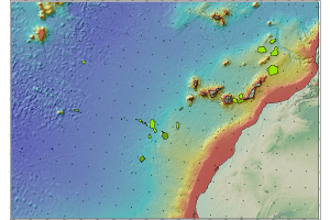
Outer Limit of the Continental Shelf of Spain to the West of the Canary Islands, United Nations Convention on the Law of the Sea
Límite exterior de la Plataforma Continental de España al Oeste de las Islas Canarias.
Outer limit of the Continental Shelf of Spain to the West of the Canary Islands.
Simple
- Date (Creation)
- 2020-12-02
- Identifier
- / ESPIGMELIMITEEXTERNODELAPLATAFORMACONTINENTALCANARIA
- Purpose
-
Límite exterior de la Plataforma Continental de España más allá de las 200 millas marinas en el área al Oeste de las Islas Canarias
Outer Limit of the Continental Shelf of Spain beyond 200 nautical miles in the area west of the Canary Islands.
- Credit
-
Teresa Medialdea (IGME), Luis Somoza (IGME), Francisco Javier Gonzalez Sanz (IGME), Ana Belen Lobato (IGME), Iker Blasco del Barrio (Personal Libre).
Teresa Medialdea (IGME), Luis Somoza (IGME), Francisco Javier Gonzalez Sanz (IGME), Ana Belen Lobato (IGME), Iker Blasco del Barrio (Personal Libre).
- Status
- On going
http://www.igme.es/
http://www.igme.es
http://www.igme.es
http://www.igme.es
- Maintenance and update frequency
- As needed
-
Tesauro IGME
IGME Thesaurus
-
-
Geología marina
Marine geology
-
Canarias
Canary islands
-
Océano Atlántico
Atlantic Ocean
-
Plataforma continental
continental shelf
-
- Discipline
-
-
Geología Marina
Marine Geology
-
Elementos Químicos
Chemical Elements
-
- Specific usage
-
Cartografia geologica e investigación de recursos minerales
Geological mapping and research of mineral resources
- Access constraints
- Other restrictions
- Other constraints
- Sin limitaciones al acceso público.
- Use constraints
- Other restrictions
- Other constraints
-
LICENCIA DE USO: Condiciones de uso público y difusión de la información para la reutilización de los datos IGME http://www.igme.es/Ayuda/CondiUso.htm
LICENSE OF USE: Conditions of public use and dissemination of information for the reuse of IGME data http://www.igme.es/Ayuda/CondiUso.htm
- Use constraints
- Other restrictions
- Spatial representation type
- Vector
- Denominator
- 250000
- Metadata language
- Spanish; Castilian
- Character set
- UTF8
- Topic category
-
- Geoscientific information
))
- Extent type code
- Yes
- Geographic identifier
- ES
- Unique resource identifier
- EPSG:4081(REGCAN95)
- Distribution format
-
-
Shape file
(
ArcGIS 10.5
)
-
Shape file
(
ArcGIS 10.5
)
Distributor
http://www.igme.es
- Fees
-
Distribución a través de la web
- OnLine resource
-
Shape of the outer limit of the Spanish Continental Shelf west of the Canary Islands, United Nations Convention on the Law of the Sea.
Acceso al .zip del límite exterior de la Plataforma Continental de España al Oeste de las Islas Canarias, Convención de Naciones Unidas sobre Derecho del Mar
Access to .zip of the outer limit of the Spanish Continental Shelf West of the Canary Islands, United Nations Convention on the Law of the Sea.
- Hierarchy level
- Dataset
Conformance result
Conformance result
- Date (Publication)
- 2008-12-04
- Explanation
-
Consultar el reglamento
Consult the regulations
- Pass
- Yes
- Statement
-
Campañas oceanograficas organizandos por el IGME, publicaciones y servidores webs
Cruises organized by the IGME, publications and web servers
- Description
-
Etapa 1 - Recopilación de la información cartográfica mediante campañas oceanograficas (datos batimétricos, sísmicos, muestras) y determinación de los límite exterior de la plataforma continental
Step 1 - Compilation of cartographic information through oceanographic surveys (bathymetric data, seismic data, samples) and determination of the outer limit of the continental shelf.
- Description
-
Etapa 2 - Estudio de las muestras obtenidas en las campañas mediante analisis de laboratorio: Fluorescencia de Rayos X (FRX), Difracción de Rayos X (DRX), Espectrometría de Masas con Plasma Acoplado Inductivamente (ICP-MS), Espectrometría de Emisión Atómica (ICP-AES), Absorción Atómica (AA) y Microscopio Electrónico de Barrido (SEM).
Stage 2 - Study of the samples obtained during the campaigns by laboratory analysis: X-ray Fluorescence (XRF), X-ray Diffraction (XRD), Inductively Coupled Plasma Mass Spectrometry (ICP-MS), Atomic Emission Spectrometry (ICP-AES), Atomic Absorption (AA) and Scanning Electron Microscopy (SEM).
- Description
-
Proyecto MINDeSEA ( https://geoera.eu/projects/mindesea2/) y EMODnet Geology ( https://www.emodnet-geology.eu/)
Proyecto MINDeSEA ( https://geoera.eu/projects/mindesea2/) and EMODnet Geology ( https://www.emodnet-geology.eu/)
- Denominator
- 250000
- File identifier
- ESPIGMELIMITEEXTERNODELAPLATAFORMACONTINENTALCANARIAS20201130 XML
- Metadata language
- Spanish; Castilian
- Character set
- UTF8
- Hierarchy level
- Dataset
- Date stamp
- 2022-10-1012T12:51:04
- Metadata standard name
-
Reglamento (CE) Nº 1205/2008 de Inspire, "Perfil IGME"
- Metadata standard version
-
2.0
http://www.igme.es
Overviews

Spatial extent
))
Provided by

 Catalogo de metadatos del IGME