 Catalogo de metadatos IGME-CSIC
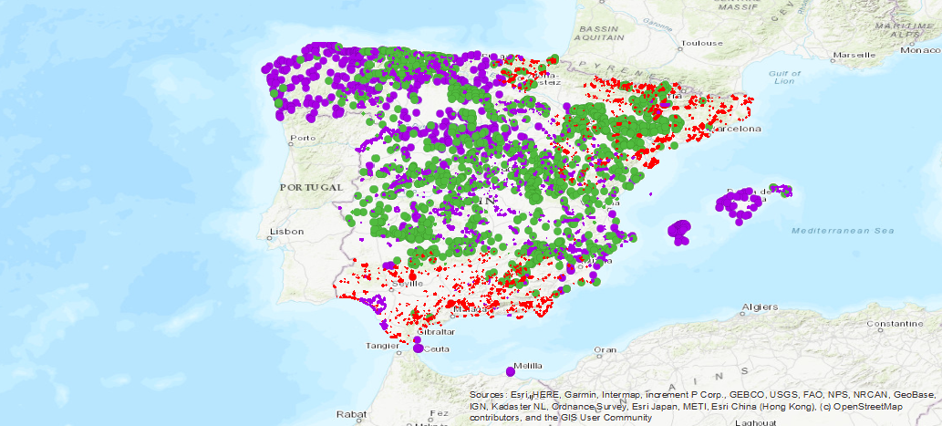
Spanish Inventory of Places of Geological Interest (IELIG)
Database of the Spanish Inventory of Places of Geological Interest (IELIG) which, in accordance with Law 42/2007, must be drawn up and updated by the Ministry of Agriculture, Food and the Environment, with the collaboration of the Autonomous Communities and scientific institutions. Royal Decree 1274/2011, entrusts the IGME with the completion of this inventory, without prejudice to the actions that the Autonomous Communities, in the use of their powers, carry out to complete it in their respective territories. Includes LIGs from the former IGME national inventory (developed basically between 1978 and 1988) and MAGNA geological mapping projects, plus sites that come from the IGME inventory carried out with the methodology designed for the IELIG but which have not been collected by the official autonomous inventories.
Simple
- Alternate title
-
IELIG
- Date (Creation)
- 1988-01-01
- Citation identifier
- IGME-CSIC / ESPIGME_BD_IELIG
- Purpose
-
The main objective of the IELIG is to identify an infrastructure of knowledge of the Spanish geological heritage that can identify and provide precise and updated information on areas or enclaves of interest belonging to the most representative geological units of Spain and the Spanish geological contexts of world relevance. To gather the places of interest, due to their unique and/or representative character, for the study and interpretation of the origin and evolution of the great Spanish geological domains, including the processes that have modelled them, the climates of the past and their paleobiological evolution.
- Credit
-
Ángel García Cortés
- Point of contact
-
Organisation name Individual name Electronic mail address Role Geological Survey of Spain (IGME-CSIC)
Juana Vegas Salamanca
Custodian
- Maintenance and update frequency
- Not planned
- Keywords
-
-
IGME
-
IELIG
-
LIG
-
Heritage
-
Site of geological interest
-
Spain
-
- Keywords
-
-
EGDI
-
- Specific usage
-
The IELIG is a necessary instrument for the knowledge, valuation and conservation of the Spanish geodiversity, as well as a source of information. for the planning and implementation of environmental policies, such as those relating to environmental impact assessment or the definition of new networks of protected areas.
- User contact info
-
Organisation name Individual name Electronic mail address Role Geological Survey of Spain (IGME-CSIC)
Point of contact
- Access constraints
- Other restrictions
- Other constraints
- No Limitations on public access
- Use constraints
- Other restrictions
- Other constraints
-
LICENSE OF USE: Conditions of public use and dissemination of information for the reuse of data. https://www.igme.es/condiciones-de-uso/
- Spatial representation type
- Vector
- Denominator
- 50000
- Denominator
- 25000
- Language
- Spanish; Castilian
- Character set
- UTF8
- Topic category
-
- Geoscientific information
))
- Extent type code
- Yes
- Geographic identifier
- ES
- Unique resource identifier
- EPSG:4326
- Unique resource identifier
- EPSG:4258
- Unique resource identifier
- EPSG:4230
- Unique resource identifier
- EPSG:23028
- Unique resource identifier
- EPSG:23029
- Unique resource identifier
- EPSG:23030
- Unique resource identifier
- EPSG:23031
- Unique resource identifier
- EPSG:25828
- Unique resource identifier
- EPSG:25829
- Unique resource identifier
- EPSG:25830
- Unique resource identifier
- EPSG:25831
- Unique resource identifier
- EPSG:3857
- Unique resource identifier
- EPSG:102100
- Distribution format
-
Name Version SHP (uso restringido)
No se aplica
Web Map Service - WMS
1.3.0
Distributor
- Distributor contact
-
Organisation name Individual name Electronic mail address Role Geological Survey of Spain (IGME-CSIC)
Distributor
- Fees
-
Distribución a través de la web
- Distributor format
-
Name Version Joint Photographic Group Format JPEG
No se aplica
Web Map Service WMS
1.3.0
Distributor
- Distributor contact
-
Organisation name Individual name Electronic mail address Role Geological Information Systems Area of the Geological Survey of Spain (IGME-CSIC)
Distributor
- Distributor format
-
Name Version Servicio web: WMS - Web Map Service
1.3.0
- OnLine resource
-
Protocol Linkage Name Servicio de visualización WMS del Inventario Español de Lugares de Interés Geológico (IELIG)
http://mapas.igme.es/gis/services/BasesDatos/IGME_IELIG/MapServer/WmsServer?REQUEST=GetCapabilities&SERVICE=WMS WWW:LINK-1.0-http--link
http://info.igme.es/ielig/ Application for access to the Spanish Inventory of Places of Geological Interest (IELIG)
- Hierarchy level
- Dataset
Conformance result
Conformance result
- Title
-
COMMISSION REGULATION (EC) No 1205/2008 of 3 December 2008 implementing Directive 2007/2/EC of the European Parliament and of the Council as regards metadata
- Date (Publication)
- 2008-12-04
- Explanation
-
Consult the regulation
- Pass
- Yes
- Statement
-
This database of the Spanish Inventory of Places of Geological Interest (IELIG) that, in accordance with Law 42/2007, should be prepared and updated by the Ministry of Agriculture, Food and Environment, with the collaboration of the Autonomous Communities and the scientific institutions. Royal Decree 1274/2011, instructs IGME to finalize this inventory.
- Description
-
The main sources of information were: the IGME Inventory of Points of Geological Interest and the various inventories existing in the autonomous communities. In addition, since the 80's of the XX century, local administrations, individual members of scientific societies and universities have given rise to various inventories of varying scope, as well as the inventory or cartographic projects of the IGME, the international project Global Geosites or regional inventory projects.
- Title
-
Inventory of Geological Points of Interest (PIGs) of the IGME and others
- Date (Creation)
- 1978-01-01
- Cited responsible party
-
Organisation name Individual name Electronic mail address Role Geological Survey of Spain (IGME-CSIC)
Juana Vegas Salamanca
Distributor
- Presentation form
- Digital document
Metadata
- File identifier
- ESPIGMEIELIGS20190627 XML
- Metadata language
- Spanish; Castilian
- Character set
- UTF8
- Hierarchy level
- Dataset
- Date stamp
- 2025-09-22T09:48:38.438577Z
- Metadata standard name
-
Reglamento (CE) Nº 1205/2008 de Inspire, "Perfil IGME"
- Metadata standard version
-
2.0
- Metadata author
-
Organisation name Individual name Electronic mail address Role Geological Survey of Spain (IGME-CSIC)
Leticia Vega Martín
Point of contact
- Other language
-
Language Character encoding English UTF8 Spanish; Castilian UTF8
)))