image/tiff
Type of resources
Available actions
Provided by
Years
Formats
status
Service types
-
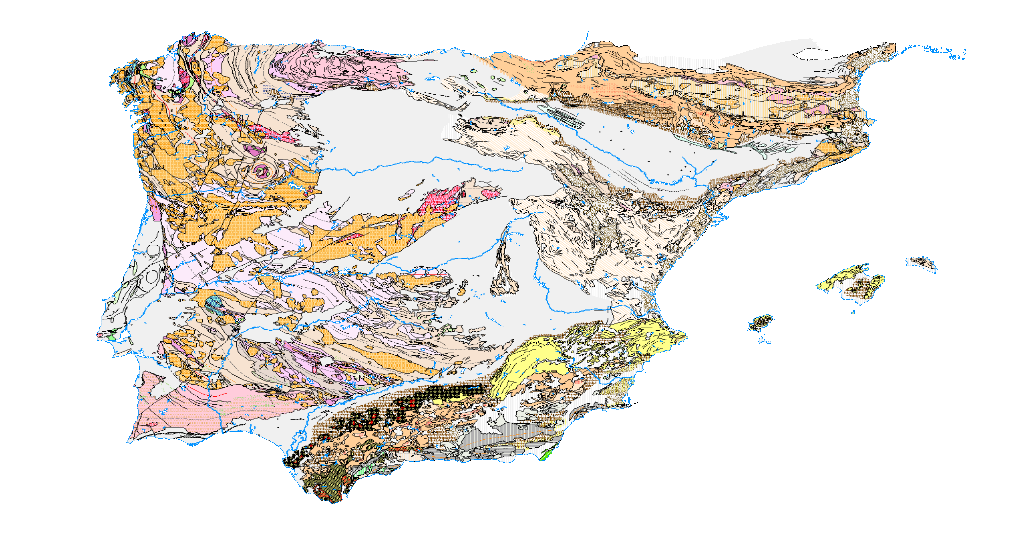
Visualisation service of the Tectonic Map in Spain at a scale of 1:1,000,000, of the Iberian Peninsula and Balearic Islands that identifies the major structural elements of the Earth's crust, and records the Earth's dynamism in the past.
-
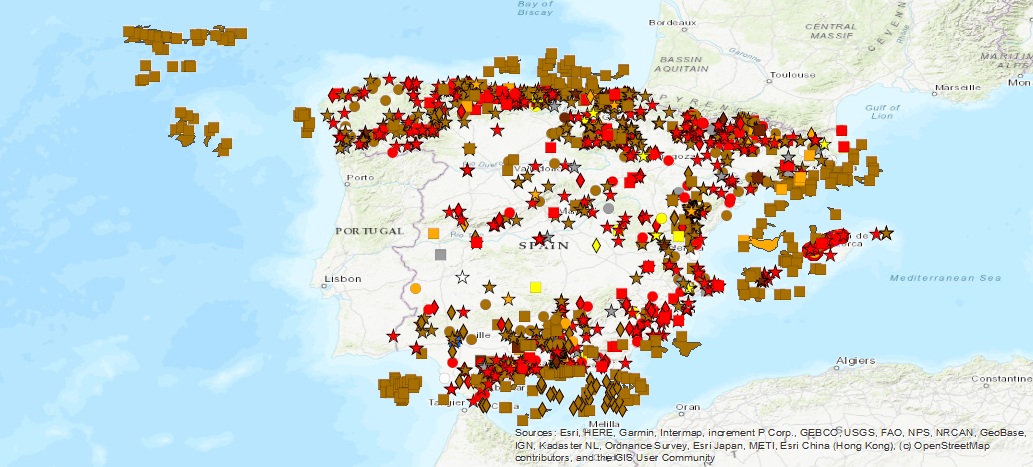
Ground Movement Database Visualisation Service (BDMOVES)
-
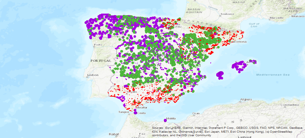
Service of visualization of the database of the Spanish Inventory of Places of Geological Interest (IELIG) which, in accordance with Law 42/2007, is prepared and updated by the Ministry of Agriculture, Food and the Environment, with the collaboration of the Autonomous Communities and scientific institutions. Royal Decree 1274/2011 entrusts the IGME with the completion of this inventory, without prejudice to the actions that the Autonomous Communities, in the use of their powers, carry out to complete it in their respective territories. For this reason, in the "origin" field of each LIG file it is indicated whether the site has been inventoried in IGME inventory or cartographic projects, in the international project Global Geosites or in autonomic inventory projects.
-
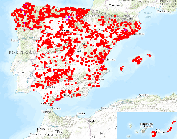
Visualisation service of the National Inventory of Mixed Type Trenches and Structures, with information on physical and geographical characteristics, type of mining, geological characteristics, impact on the environment, possibility of exploitation, etc. Information compiled up to 1989. The reference systems offered by this service are: CRS:84, EPSG:4326, EPSG:4258, EPSG:4230, EPSG:23028, EPSG:23029, EPSG:23030, EPSG:23031, EPSG:25828, EPSG:25829, EPSG:25830, EPSG:25831.
-
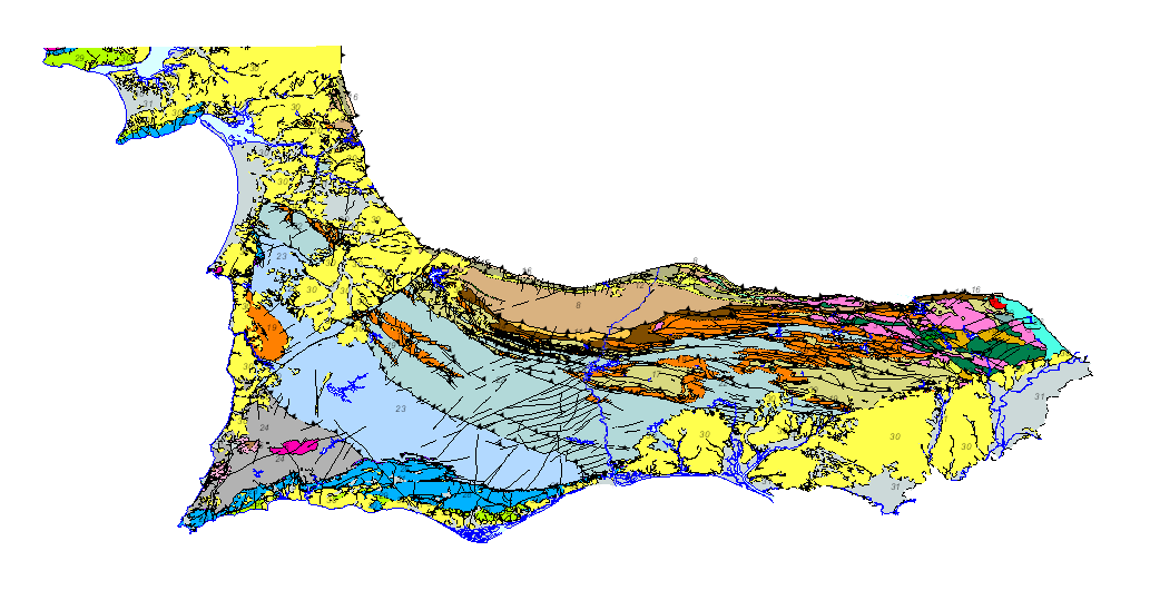
Geological map of the South Portuguese Zone, at a scale of 1/400,000, in which the geological legend on both sides of the border has been harmonized, with unified criteria between Spain and Portugal. This cartography is a product resulting from the GEO_FPI project: GEO_FPI: cross-border observatory for the geo-economic evaluation of the Iberian Pyrite Belt, financed by the European Regional Development Fund (ERDF) within the program INTERREG V-A Spain– Portugal (POCTEP) 2014-2020. The main beneficiary of the project is the Geological Survey of Spain (IGME) . Additionally, the General Directorate of Industry, Energy and Mines of the Ministry of Employment, Enterprise and Commerce of the Andalusian Government (JA) and the Portuguese National Laboratory for Energy and Geology (LNEG) and the Municipal Chamber of Aljustrel (CMA) are partners of the project.
-
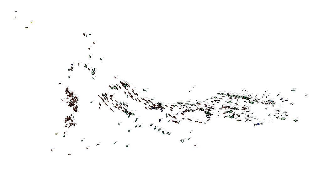
Metallogenic map of the South Portuguese Zone at a scale of 1 / 400,000, in which on the harmonized geological basis, with unified criteria between Spain and Portugal, the main metallic mineral occurrences located in the area have been represented, indicating their magnitude, substance and morphology. This cartography is a product resulting from the GEO_FPI project: GEO_FPI: cross-border observatory for the geo-economic evaluation of the Iberian Pyrite Belt, financed by the European Regional Development Fund (ERDF) within the program INTERREG V-A Spain– Portugal (POCTEP) 2014-2020. The main beneficiary of the project is the Geological Survey of Spain (IGME). Additionally, the General Directorate of Industry, Energy and Mines of the Ministry of Employment, Enterprise and Commerce of the Andalusian Government (JA) and the Portuguese National Laboratory for Energy and Geology (LNEG) and the Municipal Chamber of Aljustrel (CMA) are partners of the project.
-
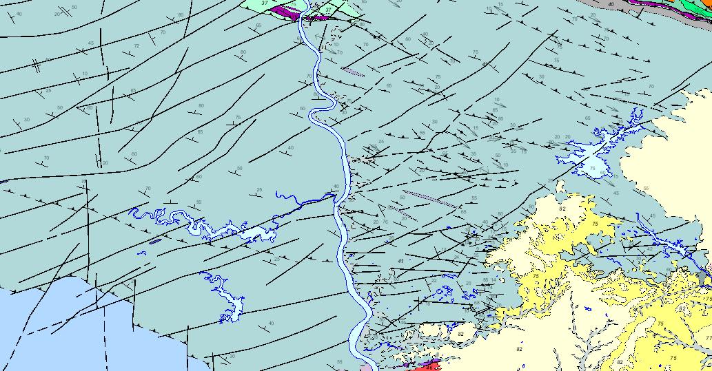
Geological map of the South Portuguese Zone on a scale of 1/200,000, in which the geological legend on both sides of the border has been harmonised with unified criteria between Spain and Portugal. This cartography is a product of the GEO_FPI project: Cross-border Observatory for the geo-economic exploitation of the Iberian Pyrite Belt, co-financed by ERDF funds through the INTERREG POCTEP 2014-2020 territorial cooperation programme. The main beneficiary of the project is the Geological Survey of Spain (IGME). The partnership for this project includes the Directorate-General for Industry, Energy and Mines of the Ministry of Finance, Industry and Energy of the Andalusian Regional Government (DGIEM), the National Laboratory of Energy and Geology, I.P. (LNEG) and the Municipal Chamber of Aljustrel (CMA).
-
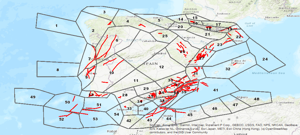
Database visualization service of seismogenic zones of the Iberian Peninsula and territories of influence for the calculation of seismic hazard in Spain (ZESIS)
-
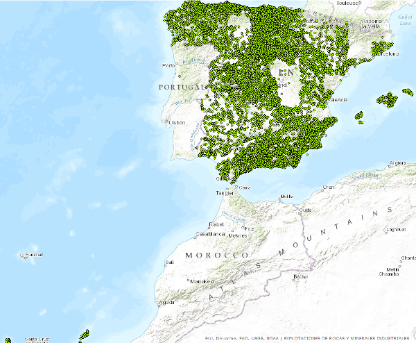
Points that symbolize the position of the indications or exploitations of Rocks and Industrial Minerals for all the national territory. Depending on the scale of visualization, two layers of points have been created. Exploitations I: represents only the location of the points. Visible from scales smaller than 1:200.000.Exploitations II: represents the location of the points with a symbolization according to different attributes. Visible from scales greater than 1:200,000. The reference systems offered by this service are: CRS:84, EPSG:4326, EPSG:4258, EPSG:4230, EPSG:23028, EPSG:23029, EPSG:23030, EPSG:23031, EPSG:25828, EPSG:25829, EPSG:25830, EPSG:25831. Puntos que simbolizan la posición de los indicios o explotaciones de Rocas y Minerales Industriales para todo el territorio nacional. En función de la escala de visualización se ha creado dos capas de puntos. Explotaciones I: representa tan sólo la localización de los puntos. Visible a partir de escalas menores de 1:200.000.Explotaciones II: representa la localización de los puntos con una simbolización en función de distintos atributos. Visible a partir de escalas mayores de 1:200.000.. Los sistemas de referencia que ofrece este servicio son:CRS:84, EPSG:4326, EPSG:4258, EPSG:4230, EPSG:23028, EPSG:23029, EPSG:23030, EPSG:23031, EPSG:25828, EPSG:25829, EPSG:25830, EPSG:25831..
-
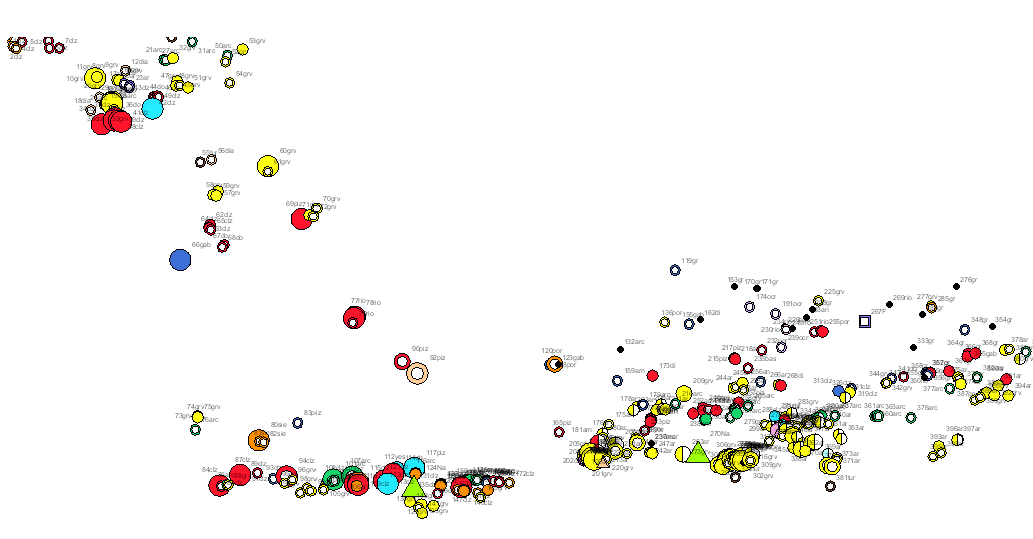
Rocks and industrial minerals map in the South Portuguese Zone, on a scale of 1/400,000, which, on a harmonised geological basis, with unified criteria between Spain and Portugal, has represented the main exploitations and indications of rocks and industrial minerals in the area, indicating their state (active, abandoned or intermittent), size, use and substance. This cartography is a product of the project GEO_FPI: Cross-border Observatory for the geo-economic exploitation of the Iberian Pyrite Belt, co-financed by ERDF funds through the INTERREG POCTEP 2014-2020 territorial cooperation programme. The main beneficiary of the project is the Geological Survey of Spain (IGME). The partnership for this project includes the Directorate-General for Industry, Energy and Mines of the Ministry of Finance, Industry and Energy of the Andalusian Regional Government (DGIEM), the National Laboratory of Energy and Geology, I.P. (LNEG) and the Municipal Chamber of Aljustrel (CMA).
 Catalogo de metadatos del IGME