 Catalogo de metadatos IGME-CSIC
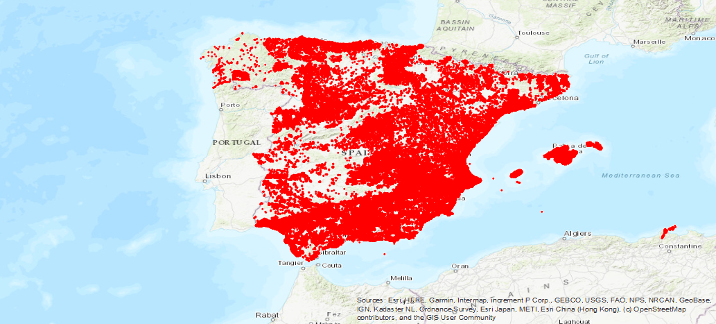
Display Service (WMS) of the IGME Water Point Base
Service of visualization of the Inventory of points of aquifers of the IGME, with data of situation, nature, utilization and technical data of the perforation. The temporal coverage extends from 1966 to the present day.
Simple
Identification info
- Date (Creation)
- 2019-07-24
- Citation identifier
- IGME-CSIC / WMS_BD_PUNTOSAGUA
- Purpose
-
On-line availability of the IGME Aquifer Point Inventory
- Point of contact
-
Organisation name Individual name Electronic mail address Role Geological Survey of Spain (IGME-CSIC)
Point of contact Geological Survey of Spain (IGME-CSIC)
Custodian
- Keywords
-
-
IGME
-
WATER
-
Water Points
-
Chemical analysis
-
Piezometric Levels
-
Levels
-
Flow rates
-
IDEE
-
-
IGME Thesaurus
-
-
Groundwater
-
Hydrometry
-
Pump tests
-
lithology
-
Spain
-
- Keywords
-
-
IDEE
-
WMS
-
InfoMapAccessService
-
-
Web Services Specifications
-
-
OGC (Open Geospatial Consortium)
-
OGC (Open Geospatial Consortium)
-
WMS (Web Map Service)
-
WMS 1.3.0
-
OGC
-
WMS
-
-
INSPIRE_SpatialDataServicesClassification
-
-
Map access service
-
Geographic information/model management service
-
- Keywords
-
-
EGDI
-
- Keywords
-
- Access constraints
- Other restrictions
- Other constraints
- No Limitations
- Use constraints
- Other restrictions
- Other constraints
-
LICENCE OF USE: Conditions of public use and dissemination of information for the re-use of IGME data. https://www.igme.es/condiciones-de-uso/
- Service Type
- view
))
- Coupling Type
- Tight
- Contains Operations
-
Operation Name Distributed Computing Platforms Connect Point GetCapabilities
Web services http://mapas.igme.es/gis/services/BasesDatos/IGME_PuntosAgua/MapServer/WMSServer GetMap
Web services http://mapas.igme.es/gis/services/BasesDatos/IGME_PuntosAgua/MapServer/WMSServer GetFeatureInfo
Web services http://mapas.igme.es/gis/services/BasesDatos/IGME_PuntosAgua/MapServer/WMSServer
- Operates On
- Unique resource identifier
- EPSG:4326
- Unique resource identifier
- EPSG:4258
- Unique resource identifier
- EPSG:4230
- Unique resource identifier
- EPSG:23028
- Unique resource identifier
- EPSG:23029
- Unique resource identifier
- EPSG:23030
- Unique resource identifier
- EPSG:23031
- Unique resource identifier
- EPSG:25828
- Unique resource identifier
- EPSG:25829
- Unique resource identifier
- EPSG:25830
- Unique resource identifier
- EPSG:25831
- Unique resource identifier
- EPSG:3857
- Unique resource identifier
- EPSG:102100
- Distribution format
-
- OnLine resource
-
Protocol Linkage Name OGC:WMS-1.3.0-http-get-capabilities
http://mapas.igme.es/gis/services/BasesDatos/IGME_PuntosAgua/MapServer/WMSServer?Request=GetCapabilities&Service=WMS&Version=1.3.0 Link to the GetCapabilities of the web service where the product is hosted
- Hierarchy level
- Service
- Other
-
Servicio web de datos espaciales. Servicio de visualización
Conformance result
- Date (Publication)
- 2009-10-19
- Explanation
-
Consult the above-mentioned regulation
- Pass
- No
Conformance result
Metadata
- File identifier
- ESPIGMESERVICIOPUNTOSAGUA20190724 XML
- Metadata language
- Spanish; Castilian
- Hierarchy level
- Service
- Hierarchy level name
-
Servicio
- Date stamp
- 2025-05-19T10:19:30.126834Z
- Metadata standard name
-
Reglamento (CE) Nº 1205/2008 de Inspire, "Perfil IGME"
- Metadata standard version
-
2.0
- Metadata author
-
Organisation name Individual name Electronic mail address Role Geological Survey of Spain IGME)
Leticia Vega Martín
Point of contact
- Other language
-
Language Character encoding English UTF8 Spanish; Castilian UTF8
)))