 Catalogo de metadatos IGME-CSIC
Servicio de visualización (WMS) del Inventario Español de Lugares de Interés Geológico
Visualization Service (WMS) of Spanish Inventory of Places of Geological Interest
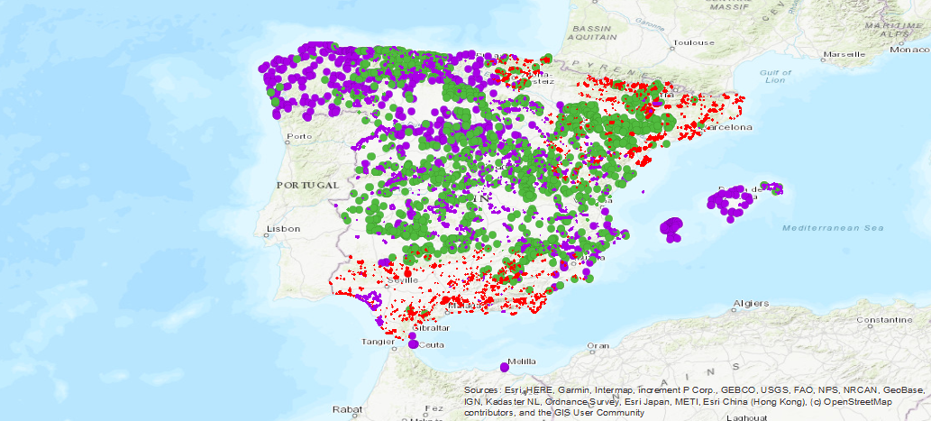
Servicio de visualización de la base de datos del Inventario Español de Lugares de Interés Geológico (IELIG) que, de acuerdo con la Ley 42/2007, elabora y actualiza el Ministerio de Agricultura, Alimentación y Medio Ambiente, con la colaboración de las Comunidades Autónomas y de las instituciones de carácter científico. El Real Decreto 1274/2011, encomienda al IGME la finalización de este inventario, sin perjuicio de las actuaciones que las Comunidades Autónomas, en uso de sus competencias, lleven a cabo para completarlo en sus respectivos territorios. Por ello, en el campo “origen” de la ficha de cada LIG se indica si el lugar ha sido inventariado en proyectos de inventario o cartográficos del IGME, en el proyecto internacional Global Geosites o en proyectos de inventario autonómicos.
Service of visualization of the database of the Spanish Inventory of Places of Geological Interest (IELIG) which, in accordance with Law 42/2007, is prepared and updated by the Ministry of Agriculture, Food and the Environment, with the collaboration of the Autonomous Communities and scientific institutions. Royal Decree 1274/2011 entrusts the IGME with the completion of this inventory, without prejudice to the actions that the Autonomous Communities, in the use of their powers, carry out to complete it in their respective territories. For this reason, in the "origin" field of each LIG file it is indicated whether the site has been inventoried in IGME inventory or cartographic projects, in the international project Global Geosites or in autonomic inventory projects.
Simple
Identification info
Información de Identificación
-
Date (Creation)Fecha (Creación)
- 2007-01-01
-
Citation identifierIdentificador del Contacto
- IGME-CSIC / WMS_BD_LIGS
-
PropósitoPurpose
-
Disponibilidad on-line del Inventario Español de Lugares de Interés Geológico (IELIG)
On-line availability of the Spanish Inventory of Places of Geological Interest (IELIG)
- Point of contact
-
Organisation name Individual name Electronic mail address Role Instituto Geológico y Minero de España (IGME-CSIC)
Geological Survey of Spain (IGME-CSIC)
Point of contactPunto de ContactoInstituto Geológico y Minero de España (IGME-CSIC)
Geological Survey of Spain (IGME-CSIC)
CustodianGuardián
- Keywords
-
-
IGME
IGME
-
IELIG
IELIG
-
LIG
LIG
-
Patrimonio
Heritage
-
Lugar Interés Geológico
Site of geological interest
-
España
Spain
-
- Keywords
-
-
InfoMapAccessService
InfoMapAccessService
-
-
Especificaciones de Servicios Web
Web Services Specifications
-
-
OGC (Open Geospatial Consortium)
OGC (Open Geospatial Consortium)
-
WMS (Web Map Service)
WMS (Web Map Service)
-
WMS 1.3.0
WMS 1.3.0
-
OGC
OGC
-
WMS
WMS
-
-
INSPIRE_SpatialDataServicesClassification
INSPIRE_SpatialDataServicesClassification
-
-
Servicio de acceso a mapas
InfoMapAccessService
-
Servicio de gestión de modelos/información geográficos
Geographic model / information management service
-
- Keywords
-
-
EGDI
EGDI
-
-
Access constraintsRestricciones de Acceso
-
Other restrictionsOtras restricciones
-
Otras limitacionesOther constraints
-
Sin limitaciones al acceso público.No Limitations
-
Use constraintsRestricciones de uso
-
Other restrictionsOtras restricciones
-
Otras limitacionesOther constraints
-
LICENCIA DE USO: Condiciones de uso público y difusión de la información para la reutilización de los datos IGME. https://www.igme.es/condiciones-de-uso/
LICENSE OF USE: Conditions of public use and dissemination of information for the reuse of IGME data. https://www.igme.es/condiciones-de-uso/
-
Service TypeTipo de Servicio
- view
))
-
Coupling TypeTipo de acoplamiento
-
TightApretado
- Contains Operations
-
Operation Name Distributed Computing Platforms Connect Point GetCapabilities
Web servicesServicios webhttp://mapas.igme.es/gis/services/BasesDatos/IGME_IELIG/MapServer/WmsServer GetMap
Web servicesServicios webhttp://mapas.igme.es/gis/services/BasesDatos/IGME_IELIG/MapServer/WmsServer GetFeatureInfo
Web servicesServicios webhttp://mapas.igme.es/gis/services/BasesDatos/IGME_IELIG/MapServer/WmsServer
-
Operates OnOpera En
-
Identificador único del recursoUnique resource identifier
-
EPSG:4326EPSG:4326
-
Identificador único del recursoUnique resource identifier
-
EPSG:4258EPSG:4258
-
Identificador único del recursoUnique resource identifier
-
EPSG:4230EPSG:4230
-
Identificador único del recursoUnique resource identifier
-
EPSG:23028EPSG:23028
-
Identificador único del recursoUnique resource identifier
-
EPSG:23029EPSG:23029
-
Identificador único del recursoUnique resource identifier
-
EPSG:23030EPSG:23030
-
Identificador único del recursoUnique resource identifier
-
EPSG:23031EPSG:23031
-
Identificador único del recursoUnique resource identifier
-
EPSG:25828EPSG:25828
-
Identificador único del recursoUnique resource identifier
-
EPSG:25829EPSG:25829
-
Identificador único del recursoUnique resource identifier
-
EPSG:25830EPSG:25830
-
Identificador único del recursoUnique resource identifier
-
EPSG:25831EPSG:25831
-
Identificador único del recursoUnique resource identifier
-
EPSG:3857EPSG:3857
-
Identificador único del recursoUnique resource identifier
-
EPSG:102100EPSG:102100
- Distribution format
-
Name Version image/png
image/png
not applicable
image/jpeg
image/jpeg
not applicable
image/tiff
image/tiff
not applicable
image/gif
image/gif
not applicable
image/bmp
image/bmp
not applicable
- Distributor contact
-
Organisation name Individual name Electronic mail address Role Instituto Geológico y Minero de España (IGME-CSIC)
Geological Survey of Spain (IGME-CSIC)
DistributorDistribuidor
- OnLine resource
-
Protocol Linkage Name OGC:WMS-1.3.0-http-get-capabilities
http://mapas.igme.es/gis/services/BasesDatos/IGME_IELIG/MapServer/WmsServer?REQUEST=GetCapabilities&SERVICE=WMS Servicio de visualización (WMS) del Inventario Español de Lugares de Interés Geológico
Visualisation Service (WMS) of the Spanish Inventory of Places of Geological Interest
-
Hierarchy levelJerarquía
-
ServiceServicio
- Other
-
Servicio web de datos espaciales. Servicio de visualización
Conformance result
Conformidad del Resultado
-
Date (Creation)Fecha (Creación)
- 2010-11-23
-
ExplicaciónExplanation
-
Consultar el reglamento mencionado
Consult the regulation mentioned above
-
PassAprobado
- No
Conformance result
Conformidad del Resultado
-
Título
-
REGLAMENTO (CE) No 1205/2008 DE LA COMISIÓN de 3 de diciembre de 2008 por el que se ejecuta la Directiva 2007/2/CE del Parlamento Europeo y del Consejo en lo que se refiere a los metadatos
-
Date (Publication)Fecha (Publicación)
- 2008-12-03
-
ExplicaciónExplanation
-
Consultar el reglamento mencionado
Consult the regulation mentioned above
-
PassAprobado
- Yes
Conformance result
Conformidad del Resultado
-
Date (Publication)Fecha (Publicación)
- 2014-12-31
-
ExplicaciónExplanation
-
Los datos no son conformesNot conformant
-
PassAprobado
- No
Metadata
-
File identifierIdentificador del fichero
- ESPIGMESERVICIOIELIGS20190627 XML
-
Metadata languageIdioma del metadato
- Spanish; Castilian
-
Character setCodificación
-
UTF8UTF8
-
Hierarchy levelJerarquía
-
ServiceServicio
- Hierarchy level name
-
Servicio
-
Date stampFecha
- 2025-09-29T10:19:22.536436Z
- Metadata standard name
-
Reglamento (CE) Nº 1205/2008 de Inspire, "Perfil IGME"
- Metadata standard version
-
2.0
- Metadata author
-
Organisation name Individual name Electronic mail address Role Instituto Geológico y Minero de España (IGME-CSIC)
Geological Survey of Spain (IGME-CSIC)
Leticia Vega Martín
Leticia Vega Martín
Point of contactPunto de Contacto
- Other language
-
Language Character encoding EnglishEnglishUTF8UTF8Spanish; CastilianSpanish; CastilianUTF8UTF8
)))