 Catalogo de metadatos IGME-CSIC
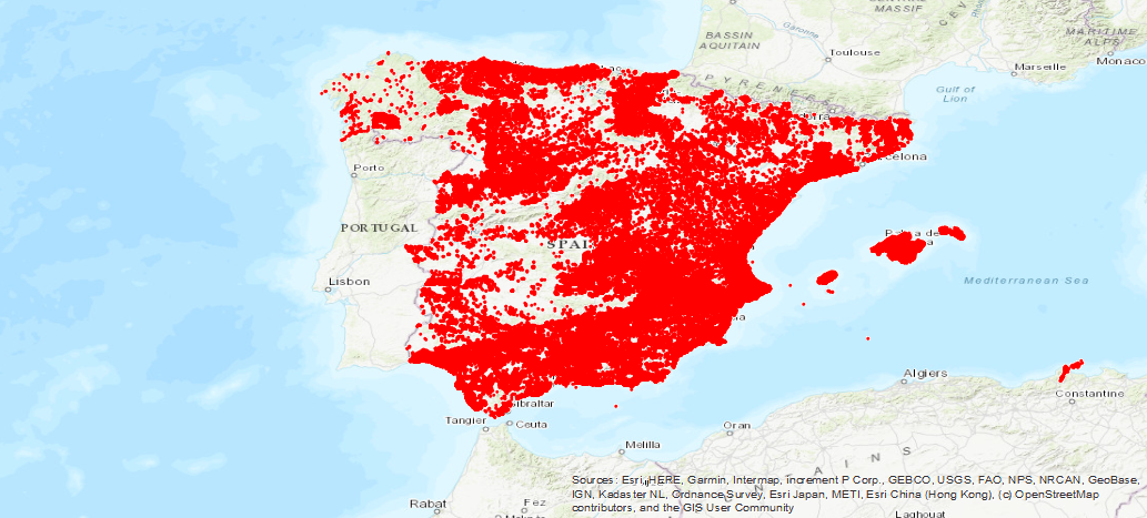
Base de datos de Puntos de Agua del IGME
IGME Water Point Database
Inventario de puntos de acuíferos del IGME, con datos de situación, naturaleza, utilización y datos técnicos de la perforación. La cobertura temporal abarca desde 1966 hasta la actualidad. Contiene el inventario de punctos acuíferos del IGME con datos de situación, naturaleza, utilización, datos técnicos de la perforación, litologías atravesadas, medidas temporales de análisis químico, piezometría caudales, ensayos de bombeo y posibles documentos asociados.
Inventory of IGME aquifer points, with location data, nature, use and technical data of the drilling. Temporary coverage ranges from 1966 to the present. It contains the inventory of aquifer punctures of the IGME with situation data, nature, use, technical data of the drilling, crossed lithologies, temporary measures of chemical analysis, piezometry, flow rates, pumping tests and possible associated documents.
Simple
-
Título alternativoAlternate title
-
Puntos de Agua. Puntos acuíferos. Base de Aguas
Water Points. Aquifer points. Water Base
-
Date (Creation)Fecha (Creación)
- 1970-01-01
-
Citation identifierIdentificador del Contacto
- IGME-CSIC / ESPIGMEPUNTOSAGUA
-
PropósitoPurpose
-
La Base de Datos de Aguas se creó en la década de los 70, con el objetivo de cubrir la necesidad del almacenamiento y manejo sencillo y rápido del gran volumen de datos en relación al conocimiento de los acuíferos subterráneos de España, su potencial hidráulico y de calidad de sus aguas, que se empezaban a generar en el IGME, fundamentalmente a partir de los Planes de Investigación de Aguas Subterráneas (PIAS) y de Gestión y Conservación de Acuíferos (PGCA) y Abastecimiento a Núcleos Urbanos (PANU). Con la creación de este archivo mecanizado que facilitara el acceso selectivo y utilización de estos datos se evitaba la pérdida de información almacenando en una única ubicación los datos de los parámetros geográfico‐administrativos, técnicos, hidrogeológicos e hidroquímicos, obtenidos a lo largo del tiempo en todos los estudios e investigaciones de las diferentes cuencas hidrográficas llevadas a cabo en el IGME. Asimismo se facilitaba la consulta de esta información a los diferentes Organismos de la administración tanto central como Autonómica, empresas privadas y particulares.
The Water Database was created in the 70s, with the objective of covering the need for simple and fast storage and handling of the large volume of data in relation to knowledge of the underground aquifers of Spain, its hydraulic potential and quality of its waters, which began to be generated in the IGME, mainly from the Underground Water Research Plans (PIAS) and Aquifer Management and Conservation (PGCA) and Urban Nucleus Supply (PANU).
With the creation of this mechanized file that facilitates the selective access and use of this data, the loss of information was avoided by storing the data of the geographic-administrative, technical, hydrogeological and geographic parameters in a single location.
hydrochemicals, obtained over time in all studies and research of the different river basins carried out in the IGME. Likewise, the consultation of this information was facilitated to the different Organisms of the administration, both central and Autonomous, private companies and individuals..
-
Crédito
-
Miguel Mejías Moreno
-
StatusEstado
-
On goingEn proceso
- Point of contact
-
Organisation name Individual name Electronic mail address Role Instituto Geológico y Minero de España (IGME-CSIC)
Geological Survey of Spain (IGME-CSIC)
Miguel Mejías Moreno
Point of contactPunto de Contacto
-
Maintenance and update frequencyMantenimiento y frecuencia de actualización
-
Not plannedSin planificar
- Keywords
-
-
IGME
IGME
-
AGUAS
WATER
-
Puntos de Agua
Water Points
-
Análisis quimicos
Chemical analysis
-
Niveles Piezométricos
Piezometric Levels
-
Niveles
Levels
-
Caudales
Flow rates
-
IDEE
IDEE
-
-
Tesauro IGME
IGME Thesaurus
-
-
Aguas subterráneas
Groundwater
-
Hidrometría
Hydrometry
-
Ensayo bombeo
Pump tests
-
Litología
lithology
-
España
Spain
-
- Keywords
-
-
EGDI
EGDI
-
- Keywords
-
-
EGDI-selection
EGDI-selection
-
-
Uso específicoSpecific usage
-
Este archivo mecanizado facilita el acceso selectivo y utilización de estos datos evitándose la pérdida de información almacenando en una única ubicación los datos de los parámetros geográfico‐administrativos, técnicos, hidrogeológicos e hidroquímicos, obtenidos a lo largo del tiempo en todos los estudios e investigaciones de las diferentes cuencas hidrográficas llevadas a cabo en el IGME. Asimismo facilitala consulta de esta información a los diferentes Organismos de la administración tanto central como Autonómica, empresas privadas y particulares.
This mechanized file facilitates the selective access and use of these data avoiding the loss of information by storing in a single location the data of the geographic-administrative, technical, hydrogeological and hydrochemical parameters, obtained over time in all studies and research of the different river basins carried out in the IGME. It also facilitates the consultation of this information to the different central and regional administration agencies, private companies and individuals.
- User contact info
-
Organisation name Individual name Electronic mail address Role Instituto Geológico y Minero de España (IGME-CSIC)
Geological Survey of Spain (IGME-CSIC)
Point of contactPunto de Contacto
-
Access constraintsRestricciones de Acceso
-
Other restrictionsOtras restricciones
-
Otras limitacionesOther constraints
-
Sin limitaciones al acceso públicoNo Limitations on public acces
-
Use constraintsRestricciones de uso
-
Other restrictionsOtras restricciones
-
Otras limitacionesOther constraints
-
LICENCIA DE USO: Condiciones de uso público y difusión de la información para la reutilización de los datos IGME. https://www.igme.es/condiciones-de-uso/
LICENCE OF USE: Conditions of public use and dissemination of information for the re-use of IGME data. https://www.igme.es/condiciones-de-uso/
-
Spatial representation typeTipo de representación espacial
-
VectorVector
-
DenominatorDenominador
- 50000
-
DenominatorDenominador
- 25000
-
LanguageIdioma
- Spanish; Castilian
-
Character setCodificación
-
UTF8UTF8
-
Topic categoryCategoría temática
-
-
Geoscientific informationInformación geocientífica
-
))
-
Extent type codeCódigo del tipo de extensión
- Yes
-
Geographic identifierIdentificador geográfico
-
ESES
-
Identificador único del recursoUnique resource identifier
-
EPSG:4326EPSG:4326
-
Identificador único del recursoUnique resource identifier
-
EPSG:4258EPSG:4258
-
Identificador único del recursoUnique resource identifier
-
EPSG:4230EPSG:4230
-
Identificador único del recursoUnique resource identifier
-
EPSG:23028EPSG:23028
-
Identificador único del recursoUnique resource identifier
-
EPSG:23029EPSG:23029
-
Identificador único del recursoUnique resource identifier
-
EPSG:23030EPSG:23030
-
Identificador único del recursoUnique resource identifier
-
EPSG:23031EPSG:23031
-
Identificador único del recurso
-
EPSG:25828
-
Identificador único del recursoUnique resource identifier
-
EPSG:25829EPSG:25829
-
Identificador único del recursoUnique resource identifier
-
EPSG:25830EPSG:25830
-
Identificador único del recursoUnique resource identifier
-
EPSG:25831EPSG:25831
-
Identificador único del recursoUnique resource identifier
-
EPSG:3857EPSG:3857
-
Identificador único del recursoUnique resource identifier
-
EPSG:102100EPSG:102100
- Distribution format
-
Name Version Shapefile - SHP
No se aplica
Web Map Service WMS
1.3.0
Distributor
Distribuidor
- Distributor contact
-
Organisation name Individual name Electronic mail address Role Vicedirección Técnica de Sistemas de Información Geológica del Instituto Geológico y Minero del España (IGME-CSIC)
Technical Vice-Directorate of Geological Information Systems of the Geological Survey of Spain (IGME-CSIC)
DistributorDistribuidor
- Fees
-
Distribución a través de la web
- Distributor format
-
Name Version Joint Photographic Group Format JPEG
No se aplica
Web Map Service WMS
1.3.0
- OnLine resource
-
Protocol Linkage Name Servicio de visualización WMS de la Base de Puntos de Agua del IGME
http://mapas.igme.es/gis/services/BasesDatos/IGME_PuntosAgua/MapServer/WMSServer?REQUEST=GetCapabilities&SERVICE=WMS WWW:LINK-1.0-http--link
http://info.igme.es/BDAguas/ Descarga de la Base de Puntos de Agua del IGME
IGME Water Point Base Download
-
Hierarchy levelJerarquía
-
DatasetConjunto de datos
Conformance result
Conformidad del Resultado
-
Date (Publication)Fecha (Publicación)
- 2014-12-31
-
ExplicaciónExplanation
-
Los datos no son conformesNot Conformant
-
PassAprobado
- No
Conformance result
Conformidad del Resultado
-
TítuloTitle
-
Reglamento (CE) No 1205/2008 de la Comisión de 3 de Diciembre de 2008 que estabelece las modalidades de aplicación de la Directiva 2007/2/CE del Parlamento Europeo y del Consejo em materia de metadados
COMMISSION REGULATION (EC) No 1205/2008 of 3 December 2008 implementing Directive 2007/2/EC of the European Parliament and of the Council as regards metadata
-
Date (Publication)Fecha (Publicación)
- 2008-12-04
-
ExplicaciónExplanation
-
Consultar el reglamento
Consult the regulations
-
PassAprobado
- Yes
-
DeclaraciónStatement
-
La Base de Datos de Aguas se creó en la década de los 70, con el objetivo de cubrir la necesidad del almacenamiento y manejo sencillo y rápido del gran volumen de datos en relación al conocimiento de los acuíferos subterráneos de España, su potencial hidráulico y de calidad de sus aguas, que se empezaban a generar en el IGME, fundamentalmente a partir de los Planes de Investigación de Aguas Subterráneas (PIAS) y de Gestión y Conservación de Acuíferos (PGCA) y Abastecimiento a Núcleos Urbanos (PANU).
La Base de Datos de Aguas, en todos estos años, en consonancia con el avance de la tecnología, ha ido pasando por diferentes equipos informáticos, sistemas operativos y gestores de bases de datos.
The Water Database was created in the 1970s, with the aim of covering the need for simple and rapid storage and handling of the large volume of data in relation to knowledge of Spain's underground aquifers, their hydraulic potential and the quality of their waters, which were beginning to be generated in the IGME, fundamentally from the Groundwater Research Plans (PIAS) and Aquifer Management and Conservation Plans (PGCA) and Urban Core Supply (PANU).
The Water Database, in all these years, in line with the progress of the technology, has gone through different computer equipment, operating systems and database managers.
-
DescripciónDescription
-
Inicialmente las principales fuentes de información fueron los Planes de Investigación de Aguas Subterráneas (PIAS) y de Gestión y Conservación de Acuíferos (PGCA) y Abastecimiento a Núcleos Urbanos (PANU). Actualmente las fuentes de trabajos que incorporan información a la base son los Proyectos de investigación hidrogeológica que se van desarrollando en el IGME, no habiendo frecuencia de actualización programada.
Initially the main sources of information were the Groundwater Research Plans (PIAS) and Aquifer Management and Conservation Plans (PGCA) and Urban Core Supply (PANU). Currently, the sources of work that incorporate information to the base are the hydrogeological research projects that are being developed in the IGME, with no scheduled update frequency.
-
TítuloTitle
-
Base de datos de Puntos de Agua del IGME
IGME Water Points Database
-
Date (Creation)Fecha (Creación)
- 1970-01-01
- Cited responsible party
-
Organisation name Individual name Electronic mail address Role Instituto Geológico y Minero de España (IGME-CSIC)
Geological Survey of Spain (IGME-CSIC)
Mejías Moreno, Miguel
Mejías Moreno, Miguel
Point of contactPunto de ContactoInstituto Geológico y Minero de España (IGME-CSIC)
Geological Survey of Spain(IGME-CSIC)
Mejías Moreno, Miguel
Mejías Moreno, Miguel
DistributorDistribuidor
-
Presentation formFormulario de presentación
-
Digital documentDocumento digital
Metadata
-
File identifierIdentificador del fichero
- ESPIGMEPUNTOSAGUA20190723 XML
-
Metadata languageIdioma del metadato
- Spanish; Castilian
-
Character setCodificación
-
UTF8UTF8
-
Hierarchy levelJerarquía
-
DatasetConjunto de datos
-
Date stampFecha
- 2026-05-22T12:49:03.646128Z
- Metadata standard name
-
Reglamento (CE) Nº 1205/2008 de Inspire, "Perfil IGME"
- Metadata standard version
-
2.0
- Metadata author
-
Organisation name Individual name Electronic mail address Role Instituto Geológico y Minero de España (IGME-CSIC)
Geological Survey of Spain (IGME-CSIC)
Leticia Vega Martín
Point of contactPunto de Contacto
- Other language
-
Language Character encoding EnglishEnglishUTF8UTF8Spanish; CastilianSpanish; CastilianUTF8UTF8
)))