 Catalogo de metadatos IGME-CSIC
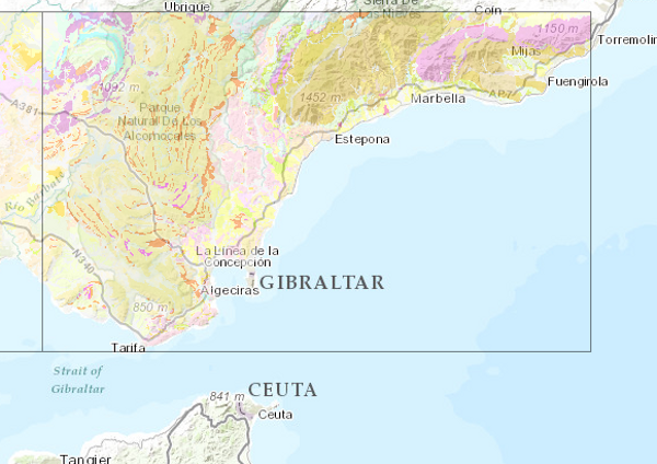
Geological Map of Spain Scale 1:200.000 (2nd series)
This Map depicts the materials or rocks that appear on the surface of the sheet, their spatial distribution, nature and geometric relationships. The cartographic units are chronostratigraphic groupings, with common lithology and age formed by strata which are called formations, groups or members; other non-stratified ones such as granites are represented. The structural relationships between them are expressed by symbols, which gives the map a three-dimensional character completed by additional geological profiles. These are the graphic expression of the deep geometrical arrangement of the units shown on the geological map. Applied information such as water points, mineral deposits and indications, presence of fossils and other elements of point representation are added by means of symbology. The printed sheets include geological sections, columns of the main zones or units and various diagrams (regional geological and tectonic diagrams, both at a scale of 1:1,000,000).
The nominal scale of the series is 1:200,000, but in the island territories it has been produced at a scale of 1:100,000.
The digital information, geological map 1:200,000, chronolithostratigraphic legend and legend of geological symbols, is stored in coverage format (ESRI). There is a guide reflecting its organisation and codification.
IGME is responsible for the execution of this series of cartography, which it finances with its own resources.
Creation of this cartography is based on the compilation of existing information, mainly MAGA cartography at a scale of 1:50,000, doctoral theses and other research work.
Simple
- Alternate title
-
Geológico 200
- Date (Creation)
- 1981-01-01
- Date (Publication)
- 1983-01-01
- Edition
-
1ª Edición
- Edition date
- 1983-01-01
- Citation identifier
- 22100_IDentificador del Centro de documentación del IGME-CSIC
- Presentation form
- Hardcopy map
- Presentation form
- Hardcopy document
- Presentation form
- Digital document
- Presentation form
- Digital map
- Presentation form
- Digital image
- Purpose
-
To create a regional geological knowledge structure from the synthesis of geological mapping on a larger scale. The objective is to provide geological information for regional planning in aspects related to geological resources, geological risks, environmental protection and communication networks.
- Credit
-
The IGME is the author and funder of the series. Several companies have collaborated as authors of the sheets in the series.
- Status
- Completed
- Point of contact
-
Organisation name Individual name Electronic mail address Role Geological Survey of Spain (IGME-CSIC)
Alejandro Robador Moreno
Point of contact
- Maintenance and update frequency
- Not planned
-
IGME Thesaurus
-
-
General geology.geology
-
Stratigraphy.lithostratigraphy
-
Stratigraphy.Chronostratigraphy
-
General geology.lithology
-
Systematics of metamorphic rocks.metamorphic rock
-
General geology.rock.crystalline rock.igneous rock
-
General geology.tectonite
-
Structural geology.fault
-
Structural geology.fold
-
Systematics of Geography.Spain
-
General geology.geological map
-
General geology
-
rock
-
sedimentary rock
-
- Keywords
-
-
relief form
-
-
GEMET
-
-
NATURAL ENVIRONMENT, ANTHROPIC ENVIRONMENT
-
LITHOSPHERE (soil, geological processes)
-
lithosphere
-
rocks
-
- Keywords
-
-
EGDI
-
InventoryGM
-
- Specific usage
-
The Geological Map of Spain Series, Scale 1:200,000, is used for all activities related to hydrogeological and mineral resources, public works, agriculture, land use, territorial planning, the environment, forecasting, prevention and mitigation of geological risks and in general with any action on the physical environment that supports decision-making in actions on the territory is a user of this cartography.
- User contact info
-
Organisation name Individual name Electronic mail address Role Geological Survey of Spain (IGME-CSIC)
Point of contact
- Access constraints
- Other restrictions
- Other constraints
- No limitations on public access.
- Use constraints
- Other restrictions
- Other constraints
-
LICENSE OF USE: Conditions of public use and dissemination of information for the reuse of data. https://www.igme.es/condiciones-de-uso/
- Title
-
Geological Map of Spain at a scale of 1:50.000 (MAGNA)
- Date (Revision)
- 1991-01-01
- Cited responsible party
-
Organisation name Individual name Electronic mail address Role Geological Survey of Spain (IGME-CSIC)
Point of contact
- Aggregate Datasetindentifier
-
20000
Geological Survey of Spain (IGME) 1979-01-01
- Association Type
- Cross reference
- Spatial representation type
- Vector
- Spatial representation type
- Grid
- Denominator
- 200000
- Denominator
- 100000
- Language
- Spanish; Castilian
- Character set
- 8859 Part 1
- Topic category
-
- Geoscientific information
))
- Supplemental Information
-
Each sheet is accompanied by an explanatory report with the following chapters: "Introduction", "Stratigraphy", "Tectonics", "Petrology", "Geological History", "Economic Geology" and "Bibliography".
- Title
-
European Petroleum Surgey Group
- Date (Creation)
- 1986-01-01
- Unique resource identifier
- EPSG:23029
- Unique resource identifier
- EPSG:23030
- Unique resource identifier
- EPSG:23031
- Unique resource identifier
- EPSG:32628
- Unique resource identifier
- EPSG:6230
- Unique resource identifier
- EPSG:7030
- Unique resource identifier
- EPSG:4258
- Distribution format
-
Name Version Mapa digital: JPEG -Joint Photographic Group Format
Unknown
Mapa digital: ARCC - Coverage of Arc-Info
Unknown
Mapa digital: ARCE - ARC/INFO Export format
Unknown
Mapa digital: SHP - ArcView ShapeFile
Unknown
Mapa en papel
Unknown
Servicio web: WMS - Web Map Service
1.3.0
Distributor
- Distributor contact
-
Organisation name Individual name Electronic mail address Role Geological Survey of Spain (IGME-CSIC)
Distributor
- Fees
-
15,03 euros por hoja y memoria en formato papel, 30 € en formato digital.
- Distributor format
-
Name Version Mapa digital: JPEG -Joint Photographic Group Format
-
Mapa digital: ARCC - Coverage of Arc-Info
-
Mapa digital: ARCE - ARC/INFO Export format
-
Mapa digital: SHP - ArcView ShapeFile
-
Distributor
- Distributor contact
-
Organisation name Individual name Electronic mail address Role Documentation Centre of the Geological Survey of Spain (IGME-CSIC)
Distributor
- Distributor format
-
Name Version Hardcopy map
-
Distributor
- Distributor contact
-
Organisation name Individual name Electronic mail address Role Geological Information Systems Area of the Geological Survey of Spain (IGME-CSIC)
Distributor
- Distributor format
-
Name Version Servicio web: WMS - Web Map Service
1.3.0
- Units of distribution
-
La serie esta programada para cubrir todo el territorio nacional y consta de 93 hojas. La escala de los territorios peninsulares y la isla de Mallorca es 1:200.000, mientras que para el resto de las islas es 1:100.000. Se han publicado las hojas número 1, 2, 7, 8, 16, 17, 26, 27, 35, 40, 42, 47, 48, 55, 56, 86, 87, 88, 92 y 93. En formato digital están disponibles las hojas 1, 2, 7, 8, 16, 17, 26, 27, 40, 42, 47, 48, 49, 55, 56, 65, 86, 87, 88, y 89. De todas estas existen servicios de mapas tipo WMS.
- OnLine resource
-
Protocol Linkage Name OGC:WMS-1.1.1-http-get-capabilities
http://mapas.igme.es/gis/services/Cartografia_Geologica/IGME_Geologico_200/MapServer/WMSServer?Request=GetCapabilities&Service=WMS Link to the GetCapabilities of the web service hosting the product
WWW:LINK-1.0-http--related
http://mapas.igme.es/Servicios/default.aspx#IGME_Geologico_200 Link to the product page on the IGME web site
- Name
- CDROM
- Hierarchy level
- Series
Completeness commission
- Name of measure
-
Phenomena that do not exist in the original mapping but do exist in the digital product
- Measure description
-
Visual spot check and cross-checking of spatial information with attribute tables.
Conformance result
- Title
-
Visual spot check and cross-checking of spatial information with attribute tables
- Date (Revision)
- 1983-01-01
- Explanation
-
Digital comparative validation and visual comparative check of the original map and the digitised map. Validation with error rate < 1%.
- Pass
- Yes
Completeness commission
- Name of measure
-
Duplicate phenomena.
- Measure description
-
Geometric and topological control using GIS application tools.
Conformance result
- Title
-
Geometric and topological control using the tools of the GIS application.
- Date (Revision)
- 1983-01-01
Citation identifier
- Explanation
-
Error rate 0 %
- Pass
- Yes
Completeness omission
- Name of measure
-
Lack of phenomena
- Measure description
-
Visual spot check and cross-checking of spatial information with attribute tables
Conformance result
- Title
-
Visual spot check and cross-checking of spatial information with attribute tables
- Date (Revision)
- 1983-01-01
Citation identifier
- Explanation
-
Digital comparative validation and visual comparative check of the original map and the digitised map. Validation with error rate < 1%.
- Pass
- Yes
Conceptual consistency
- Name of measure
-
Degree of approximation of the digital data with the conceptual model. Distribution of phenomena in classes
- Measure description
-
Manual verification.
Conformance result
- Title
-
MAGNA geological mapping data model in digital format.
- Date (Revision)
- 2012-02-01
Citation identifier
- Explanation
-
Check that the digital information is consistent with the standards that conceptually define it. Consult the standard
- Pass
- Yes
Conceptual consistency
- Name of measure
-
Degree of approximation of the digital data with the conceptual model. Properties of the phenomena
- Measure description
-
Automatic verification.
Conformance result
- Title
-
MAGNA geological mapping data model in digital format.
- Date (Revision)
- 2012-02-01
Citation identifier
- Explanation
-
Check that the digital information is consistent with the standards that conceptually define it. Consult the standard
- Pass
- Yes
Conceptual consistency
- Name of measure
-
Degree of approximation of the digital data with the conceptual model. Relationships between phenomena.
- Measure description
-
Automatic verification.
Conformance result
- Title
-
MAGNA geological mapping data model in digital format.
- Date (Revision)
- 2012-02-01
Citation identifier
- Explanation
-
Check that the digital information is consistent with the standards that conceptually define it. Consult the standard
- Pass
- Yes
Format consistency
- Name of measure
-
Degree of approximation of the data to the established physical structure.
- Measure description
-
Automatic verification.
Conformance result
- Title
-
Specifications for the digitisation of MAGNA geological mapping.
- Date (Revision)
- 2012-02-01
Citation identifier
- Explanation
-
Check that the digital information is in accordance with the standards. Consult the standard
- Pass
- Yes
Absolute external positional accuracy
- Name of measure
-
External absolute accuracy
- Measure description
-
Error cuadrático medio en el registro del mapa para digitalizar.
Conformance result
- Title
-
Mean square error in the registration of the map to be digitised.
- Date (Revision)
- 1983-01-01
- Explanation
-
Verification that the positional error is less than that required by the scale of the map < 40 m
- Pass
- Yes
Thematic classification correctness
- Name of measure
-
Absence of errors in the assignment of classes to phenomena.
- Measure description
-
Comparative study with original map. Random sampling
Conformance result
- Title
-
Data model of the MAGNA geological mapping in digital format. Specifications for the digitisation of MAGNA geological mapping.
- Date (Revision)
- 2012-02-01
- Explanation
-
Digital comparative validation and visual comparative check of the original map and the digitised map. Validation with error rate < 1%.
- Pass
- Yes
Thematic classification correctness
- Name of measure
-
Absence of errors in the assignment of identifiers to cartographic units.
- Measure description
-
Comparative study with original map.
Conformance result
- Title
-
Comparative study with original map.
- Date (Revision)
- 1983-01-01
- Explanation
-
Digital comparative validation and comparative visual check of the original map and the digitised map. Error rate 1%. Error area < 0.1% in cartographic units.
- Pass
- Yes
Non quantitative attribute accuracy
- Name of measure
-
Accuracy of non-quantitative attributes: absence of errors in the assignment of values.
- Measure description
-
Comparative study with original map
Conformance result
- Title
-
Comparative study with original map
- Date (Revision)
- 1983-01-01
- Explanation
-
Digital comparative validation and comparative visual check of the original map and the digitised map. Error rate 1%. Error area < 0.1% in cartographic units.
- Pass
- Yes
Quantitative attribute accuracy
- Name of measure
-
Accuracy of quantitative attributes: absence of errors in the assignment of values.
- Measure description
-
Comparative study with original map
Conformance result
- Title
-
Comparative study with original map
- Date (Publication)
- 1983-01-01
- Explanation
-
Digital check of digital information. Error rate 1%. Error area < 0.1% in cartographic units.
- Pass
- Yes
Conformance result
- Date (Publication)
- 2010-12-08
Citation identifier
- Explanation
-
Consult the regulation
- Pass
- No
Conformance result
Conformance result
- Statement
-
In summary, it can be said that the cartography of the Geological Map of Spain Scale 1:200.000, 2nd series, is based on the fundamental reference of the Geological Map of Spain Scale 1:50.000, MAGNA, (2nd Series); it begins with the compilation and analysis of the rest of the information related to the area and its surroundings, including topographic bases and other cartographies and related works such as singular projects, doctoral theses, etc. The next step is the study of the cartographic units and the revision of the available map samples, some field revision with the collection of data and samples for later study, simultaneously with some required photogeological interpretation, is the next step. Then, the transfer of the field work to the map and the subsequent elaboration of the map, supported by photo-interpretation works. The elaboration of the text of the report and that of the complementary information and its organisation complete the process.
Finally, the information is digitised.
Supervision, correction and validation following the Institute's digital cartography revision procedure, which consists of error detection and correction controls and thorough visual checks.
- Description
-
Search, compilation and analysis of previous information:
Bibliographic information.
Topographical base and digital terrain model.
Geological Map of Spain 1:50.000, MAGNA. Environmental sheets.
Other maps and previous documents.
Study of the cartographic units and review of the samples Previous synthesis.
- Description
-
Field work:
Field verification and data collection.
Additional sampling.
- Description
-
Production of the maps and Memory:
Elaboration of the chronostratigraphic legend.
Spatial adjustment between sheet boundaries.
Photointerpretation and elaboration of the provisional map on the topographic base.
Elaboration and drawing of the definitive map.
Study of the analytical data.
Elaboration of the text of the Report.
- Description
-
Process of digitalisation of the information:
Analysis of the entities present in the cartography. Assignment of codes.
Digitisation of geological contacts and faults. Generation of the enclosures that constitute the cartographic units. Digitisation of the rest of the geological entities. Digitisation of the chronolithostratigraphic legend.
The entire digitisation process is carried out in accordance with the specifications drawn up by the IGME.
(Process carried out with Arc/Info version 7 or later).
Generation of singular external tables and loading of attributes.
(Process carried out with Arc/Info version 7 or later).
Control of topological and coding errors by means of automatic processes executed through applications carried out at the IGME.
Visual control of errors between the symbolised digital product and the original map.
- Description
-
Process of digitalisation of the information:
Analysis of the entities present in the cartography. Assignment dThe materials or rocks that appear on the surface of the sheet, their spatial distribution, nature and geometric relationships are represented. Mapping units are groupings with common lithology and age formed by strata or other unstratified rocks such as granites. The structural relationships between them are expressed by symbols, which gives the map a three-dimensional character that is completed by additional geological profiles that are the graphical expression of their geometry in depth. Symbology adds information, some of an applied nature such as water points, deposits and mineral indications.
- Denominator
- 50000
- Title
-
Geological Map of Spain at a scale of 1:50.000 MAGNA (Second series 1st edition)
- Date (Revision)
- 1991-01-01
- Cited responsible party
-
Organisation name Individual name Electronic mail address Role Geological Survey of Spain (IGME-CSIC)
Originator Geological Survey of Spain (IGME-CSIC)
Distributor
- Presentation form
- Hardcopy document
- Presentation form
- Hardcopy map
- Presentation form
- Digital document
- Presentation form
- Digital map
Metadata
- File identifier
- ESPIGMEGEOLOGICO2002009111022100 XML
- Metadata language
- Spanish; Castilian
- Character set
- UTF8
- Hierarchy level
- Series
- Hierarchy level name
-
Mapa Geológico de España Escala 1:200.000 (2ª serie)
- Date stamp
- 2026-03-11T13:35:59.743788Z
- Metadata standard name
-
Reglamento (CE) Nº 1205/2008 de Inspire, "Perfil IGME"
- Metadata standard version
-
2.0
- Metadata author
-
Organisation name Individual name Electronic mail address Role Geological Survey of Spain (IGME-CSIC)
Leticia Vega Martín
Point of contact
- Other language
-
Language Character encoding English UTF8 Spanish; Castilian UTF8
)))