 Catalogo de metadatos IGME-CSIC
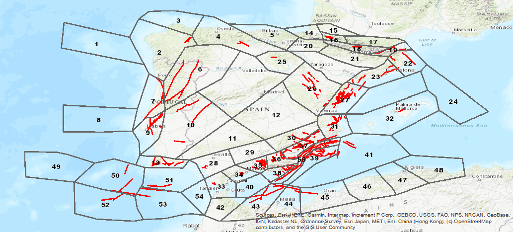
Visualization Service (WMS) of the Seismogenic Database of Spain
Database visualization service of seismogenic zones of the Iberian Peninsula and territories of influence for the calculation of seismic hazard in Spain (ZESIS)
Simple
Identification info
- Date (Creation)
- 2007-01-01
- Citation identifier
- ESPIGMESERVICIOZESIS20190703
- Purpose
-
On-line availability of the database of seismogenic zones of the Iberian Peninsula and territories of influence for the calculation of seismic hazard in Spain (ZESIS).
- Point of contact
-
Organisation name Individual name Electronic mail address Role Geological Survey of Spain (IGME-CSIC)
Point of contact Geological Survey of Spain (IGME-CSIC)
Custodian
-
Tesauro IGME
-
-
IGME
-
ZESIS
-
Seismogenic Zoning of Iberia
-
Seismogenic Zones
-
Seismic hazard
-
QAFI
-
Quaternary
-
Fault
-
Iberia
-
Earthquake
-
Paleoseismology
-
Tectonics
-
Spain
-
Portugal
-
- Keywords
-
-
EGDI
-
- Keywords
-
-
EGDI-selection
-
- Keywords
-
-
WMS
-
-
Especificaciones de Servicios Web
-
-
OGC (Open Geospatial Consortium)
-
WMS (Web Map Service)
-
WMS 1.3.0
-
OGC
-
WMS
-
-
ISO - 19119 geographic services taxonomy
-
-
infoMapAccessService
-
-
INSPIRE_SpatialDataServicesClassification
-
-
Servicio de acceso a mapas
-
Servicio de gestión de modelos/información geográficos
-
- Access constraints
- Other restrictions
- Other constraints
- No Limitations
- Use constraints
- Other restrictions
- Other constraints
-
LICENSE OF USE: Conditions of public use and dissemination of information for the reuse of IGME data http://www.igme.es/Ayuda/CondiUso.htm
- Service Type
- view
))
- Coupling Type
- Tight
- Contains Operations
-
Operation Name Distributed Computing Platforms Connect Point GetCapabilities
Web services http://mapas.igme.es/gis/services/BasesDatos/IGME_ZESIS/MapServer/WmsServer GetMap
Web services http://mapas.igme.es/gis/services/BasesDatos/IGME_ZESIS/MapServer/WmsServer GetFeatureInfo
Web services http://mapas.igme.es/gis/services/BasesDatos/IGME_ZESIS/MapServer/WmsServer
- Unique resource identifier
- EPSG:4326
- Unique resource identifier
- EPSG:4258
- Unique resource identifier
- EPSG:4230
- Unique resource identifier
- EPSG:23028
- Unique resource identifier
- EPSG:23029
- Unique resource identifier
- EPSG:23030
- Unique resource identifier
- EPSG:23031
- Unique resource identifier
- EPSG:25828
- Unique resource identifier
- EPSG:25829
- Unique resource identifier
- EPSG:25830
- Unique resource identifier
- EPSG:25831
- Unique resource identifier
- EPSG:3857
- Unique resource identifier
- EPSG:102100
- Distribution format
-
Name Version image/png
not applicable
image/jpeg
not applicable
image/tiff
not applicable
image/gif
not applicable
image/bmp
not applicable
- Distributor contact
-
Organisation name Individual name Electronic mail address Role Geological Survey of Spain (IGME-CSIC)
Distributor
- OnLine resource
-
Protocol Linkage Name OGC:WMS-1.3.0-http-get-capabilities
http://mapas.igme.es/gis/services/BasesDatos/IGME_ZESIS/MapServer/WmsServer?REQUEST=GetCapabilities&SERVICE=WMS Servicio de visualización (WMS) de la Base de datos sismogénicas de España
- Hierarchy level
- Service
- Other
-
Servicio web de datos espaciales. Servicio de visualización
Conformance result
- Date (Publication)
- 2009-10-19
- Explanation
-
Consult the regulation mentioned above
- Pass
- No
Conformance result
Conformance result
Conformance result
- Title
-
REGLAMENTO (CE) No 1205/2008 DE LA COMISIÓN de 3 de diciembre de 2008 por el que se ejecuta la Directiva 2007/2/CE del Parlamento Europeo y del Consejo en lo que se refiere a los metadatos
- Date (Publication)
- 2008-12-03
- Explanation
-
Consultar el reglamento mencionado
- Pass
- Yes
Metadata
- File identifier
- ESPIGMESERVICIOZESIS20190703 XML
- Metadata language
- Spanish; Castilian
- Character set
- UTF8
- Hierarchy level
- Service
- Hierarchy level name
-
Servicio
- Date stamp
- 2025-05-09T05:37:12.855827Z
- Metadata standard name
-
Reglamento (CE) Nº 1205/2008 de Inspire, "Perfil IGME"
- Metadata standard version
-
2.0
- Metadata author
-
Organisation name Individual name Electronic mail address Role Geological Survey of Spain (IGME-CSIC)
Leticia Vega Martín
Point of contact
- Other language
-
Language Character encoding English UTF8 Spanish; Castilian UTF8
)))