 Catalogo de metadatos IGME-CSIC
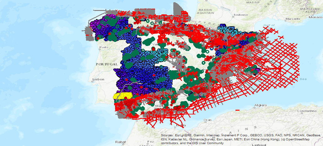
WMS visualization service of the IGME geophysical database (SIGEOF)
Geophysical database visualization service available in the IGME corresponding to the following methodologies: Electrical (SEV, SEDT and Electrical Profiles), Witnessing, Gravimetry, Petrophysics, Aeroportado (flight lines and meshes), Electomagnetic (MT) and Seismic (seismic lines and seismic sections ).
Simple
Identification info
- Date (Creation)
- 2019-09-11
- Citation identifier
- IGME-CSIC / WMS_BD_SIGEOF
- Purpose
-
Online availability of the geophysical database available in the IGME (SIGEOF)
- Point of contact
-
Organisation name Individual name Electronic mail address Role Geological Survey of Spain (IGME-CSIC)
Point of contact Geological Survey of Spain (IGME-CSIC)
Custodian
-
IGME Thesaurus
-
-
IGME
-
Gavimetry
-
Petrophysics
-
Airlifted
-
Electrical
-
Electromagnetic
-
Testification
-
Geophysics
-
Seismic
-
Well-logging
-
lithology
-
Spain
-
- Keywords
-
-
EGDI
-
- Keywords
-
-
Especificaciones de Servicios Web
-
-
OGC (Open Geospatial Consortium)
-
WMS (Web Map Service)
-
WMS 1.3.0
-
OGC
-
WMS
-
-
INSPIRE_SpatialDataServicesClassification
-
-
InfoMapAccessService
-
Geographic model/information management service
-
- Access constraints
- Other restrictions
- Other constraints
- Sin limitaciones al acceso público.
- Use constraints
- Other restrictions
- Other constraints
-
LICENSE OF USE: Conditions of public use and dissemination of information for the reuse of IGME data. https://www.igme.es/condiciones-de-uso/
- Service Type
- view
))
- Coupling Type
- Tight
- Contains Operations
-
Operation Name Distributed Computing Platforms Connect Point GetCapabilities
Web services https://mapas.igme.es/gis/services/BasesDatos/IGME_SIGEOF/MapServer/WmsServer GetMap
Web services https://mapas.igme.es/gis/services/BasesDatos/IGME_SIGEOF/MapServer/WMSServer GetFeatureInfo
Web services https://mapas.igme.es/gis/services/BasesDatos/IGME_SIGEOF/MapServer/WMSServer
- Unique resource identifier
- EPGS:4326
- Unique resource identifier
- EPGS:4258
- Unique resource identifier
- EPGS:4230
- Unique resource identifier
- EPGS:23028
- Unique resource identifier
- EPGS:23029
- Unique resource identifier
- EPGS:23030
- Unique resource identifier
- EPGS:23031
- Unique resource identifier
- EPGS:25828
- Unique resource identifier
- EPGS:25829
- Unique resource identifier
- EPGS:25830
- Unique resource identifier
- EPGS:25831
- Unique resource identifier
- EPGS:3857
- Unique resource identifier
- EPGS:102100
- Distribution format
-
- OnLine resource
-
Protocol Linkage Name OGC:WMS-1.3.0-http-get-capabilities
https://mapas.igme.es/gis/services/BasesDatos/IGME_SIGEOF/MapServer/WmsServer?Request=GetCapabilities&Service=WMS&Version=1.3.0 Link to the GetCapabilities of the web service where the product is hosted
- Hierarchy level
- Service
- Other
-
Servicio web de datos espaciales. Servicio de visualización
Conformance result
- Date (Publication)
- 2009-10-19
- Explanation
-
Consult the above-mentioned regulation
- Pass
- No
Conformance result
Conformance result
- Title
-
REGLAMENTO (CE) No 1205/2008 DE LA COMISIÓN de 3 de diciembre de 2008 por el que se ejecuta la Directiva 2007/2/CE del Parlamento Europeo y del Consejo en lo que se refiere a los metadatos
- Date (Publication)
- 2008-12-03
- Explanation
-
Consult the above-mentioned regulation
- Pass
- Yes
Metadata
- File identifier
- ESPIGMESERVICIOSIGEOF20190911 XML
- Metadata language
- Spanish; Castilian
- Hierarchy level
- Service
- Hierarchy level name
-
Servicio
- Date stamp
- 2025-05-19T12:51:43.429843Z
- Metadata standard name
-
Reglamento (CE) Nº 1205/2008 de Inspire, "Perfil IGME"
- Metadata standard version
-
2.0
- Metadata author
-
Organisation name Individual name Electronic mail address Role Geological Survey of Spain (IGME-CSIC)
Leticia Vega Martín
Point of contact
- Other language
-
Language Character encoding English UTF8 Spanish; Castilian UTF8
)))